|
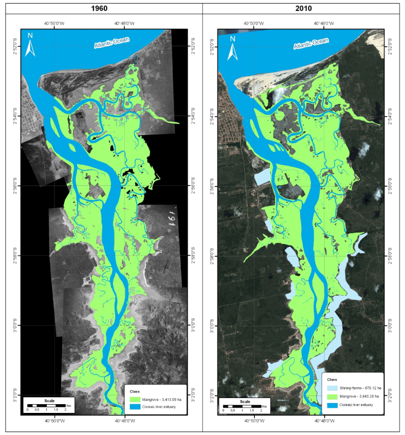
| Figure 3: Thematic maps and area estimations of coastal wetland distribution in the Coreaú river estuary. Land cover categories obtained by digitisation and by means of a supervised classification for aerial photographs of 1960, Landsat Geocover of 1999-2000, CBERS of 2009-2010 and Google Earth images. |