|
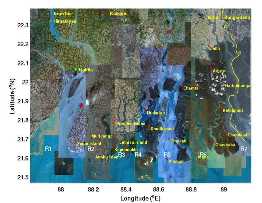
| Figure 3: Map of the study region with 2 stations marked in red. The western station is located at 21° 52’ 20.78” N, 88° 7’ 29.73” E, at the tip of Sagar Island. The seven rivers marked by R1 through R7 from west to east are: Hooghly, Muriganga, Saptamukhi, Thakuran, Matla, Gosaba and Harinbhanga. The groundwater discharge system of the two metropolis of Haldia and Kolkata (Calcutta) are connected to the two western rivers, which are also fed by the meltwater from the Himalayas as shown. The eastern station, at 22° 15’ 33.97” N, 88° 39’ 34.64” E, is connected to the rivers R4 and R5 which do not have such connection with the Himalayas. |