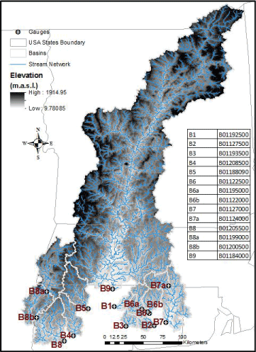
Figure 1:
Map of Connecticut River Basin showing the drainage areas of the subbasins used in this study. The black dots represent streamflow gauges labeled with USGS station numbers.