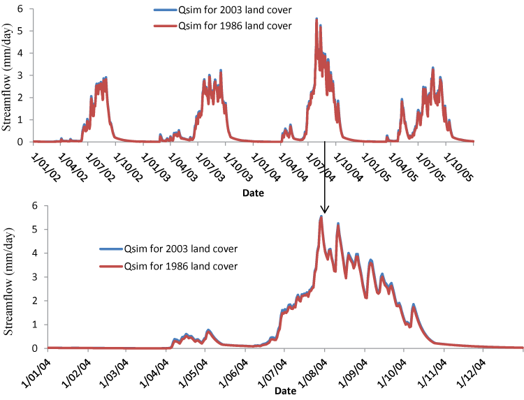
Figure 8:
Simulated streamflows for the year 2004 (lower panel) and for 2002-2005 (upper panel), using the 1986 and 2003 land cover for the Melka Kuntrie subbasin.