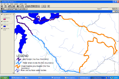
Figure 8:
Boundaries of the Model Area with Major Internal Features of Pallisa District, eastern Uganda using ESRI-Arc View v3.2a.