|
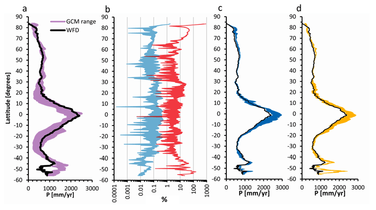
| Figure 1: a) Overland latitudinal averages of observed (black line) and past 3 GCMs’ mean annual precipitation (purple area), b) range of remaining bias from observed mean precipitation of three GCMs’ precipitation using MSBC (blue) and WSBC (red) bias correction methods, c) range of projected latitudinal mean annual precipitation of 2001-2100 period from three GCMs and two emission scenarios using MSBC bias correction method – black line indicates the latitudinal 1960-2000 average of observed precipitation, d) same as c, but using WSBC bias correction method. Black lines correspond to mean annual observed precipitation for 1960-2000 periods. |