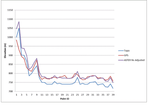
Figure 6:
Re-adjusted ASTER Pixel values using MLR model applying both GPS and topographic map points.