|
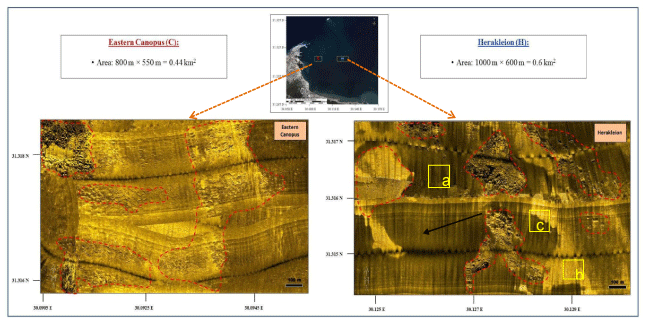
| Figure 10: Mosaic maps show the estimated impact (dash red color) of the two ancient cities on the seafloor including the borders of some ruins. The location of the a, b and c refer to the darker, lighter and tonal patches patterns of side-scan sonar backscattered data. |