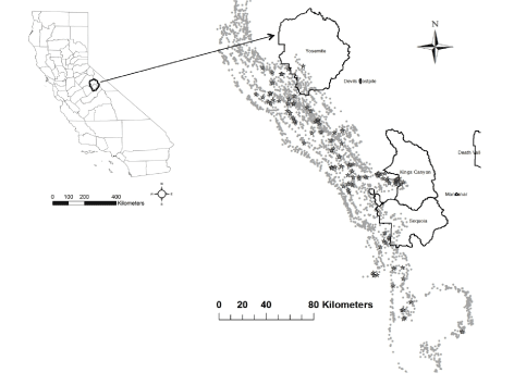
Figure 1:
Map of USFS Aerial Survey Points with high tree mortality of the south Sierra Nevada from April, 2015 shaded in gray, and for Landsat dNDVI (2015-2011) < -2000 in star symbols (N = 91).