|
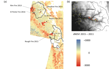
| Figure 6: (a) Map of Landsat dNDVI for 2015-2011 for the southern Sierra Nevada foothill and mountain region; (b) Map of USFS Aerial Survey Points with high tree mortality from April, 2015 near Kings Canyon NP in yellow star symbols; with dNDVI of 2015-2011 < -3500 in red star symbols. |