|
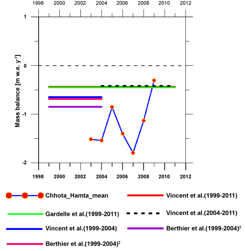
| Figure 4: Showing all the available compiled mass balance data including glaciological, geodetic, remote sensing studied by different organizations for the period 1999 to 2011. Scatter plot (red symbol) in the figure representing the mean mass balance for both (Chhota Shigri and Hamta) the glaciers for same years. Red line (behind green line) representing the mean geodetic mass balance year-1 during 1999 to 2011 for whole Lahaul-Spiti region. Green line represents mean mass balance year-1 using remote sensing between same time periods for the same study region. Black dashed line showing the mean values of mass balance during 2004 to 2011. Violet and pink lines are representing the mass balance values between 1999 to 2004 using two different hypothesis (Hypothesis 1 and Hypothesis 2) over the same region. Error ranges are not shown in this figure. |