| Research Article |
Open Access |
|
| David Chikodzi* and Godfrey Mutowo |
| Great Zimbabwe University, Department of Physics, Geography and Environmental Science, Masvingo, Zimbabwe |
| *Corresponding author: |
David Chikodzi
Great Zimbabwe University, Department of Physics
Geography and Environmental Science, Masvingo, Zimbabwe
e-mail: dchikodzi@gzu.ac.zw; dchikodzi@hotmail.com |
|
| |
| Received September 05, 2012; Published September 20, 2012 |
| |
| Citation: Chikodzi D, Mutowo G (2012) Agro-Ecological Zonation of Masvingo Province: Land Suitability Classification Factoring In Climate Change, Variability Swings and New Technology. 1:318. |
| |
| Copyright: © 2012 Chikodzi D, et al. This is an open-access article distributed under the terms of the Creative Commons Attribution License, which permits unrestricted use, distribution, and reproduction in any medium, provided the original author and source are credited. |
| |
| Abstract |
| |
| The aim was to produce a land suitability map which shows new agro-ecological zones in Masvingo province. The current agro-ecological regions, developed in the 1960s are now ineffective and outdated mainly due to climate change, technological change has brought new methods and tools that have a more realistic and practical classification of regions according to their agricultural potential. The input parameters, which are climatic features, soil characteristics, physiographic features and water body availability, were populated into a GIS database for processing. The different parameter maps were then weighted and combined to produce a land suitability map of Masvingo. |
| |
| Keywords |
| |
| Agro-ecological zones; Land resources database; Factor suitability classification; Analytical hierarchy process; Fussy logic and GIS. |
| |
| Introduction |
| |
| Agro-ecological regions are land areas characterised by similar climate, ecology and agricultural activities.They are important because: |
| |
| 1. They show how land with different potentials and constraints distributed within the country, provinces or districts. |
| |
| 2. They enable provision of appropriate, area-specific, extension information and advice, enable the setting of agricultural research priorities, and the establishment of networks for agrotechnology transfer. |
| |
| 3. The identification of particular development programmes or projects specific to an area. |
| |
| 4. They are standard tools for prioritising agricultural research and investment because they offer relevant, available information about target environments. |
| |
| Investment in agriculture is increasingly being directed at agroecological zones where output benefits are expected to be greatest. This requires that the zones themselves be well defined first. (Corbett, FAO, White, Fischer)[1-4]. Previous work on AEZs in Zimbabwe was done by Vincent and Thomas [5], Venema [6], Mugandani [7] and Kainamura [8]. |
| |
| 1. Vincent and Thomas [5], divided Zimbabwe into five AEZ. They however did not consider effective rainfall, did not consider anomalies in length of growing season for individual stations in Zimbabwe, and used a database with very few data and less developed tools. Technological change has brought new methods and techniques, better updated and managed databases, hence there is need to reclassify these zones. Due to the effects of climate change, Zimbabwe now has more hot days and fewer cold days as compared to the 1960s when Vincent and Thomas did their agro-ecological zonation of Zimbabwe. |
| |
| There has also been the expansion of arid conditions into regions that were previously semi arid, this has been exacerbated by serious and more frequent precipitation deviation from the mean that makes it even more difficult to schedule the best time for crop cultivation. This makes the agro- ecological zones less effective as a planning tool for viable agricultural production. |
| |
| 2. Venema [6] took the zones derived by Vincent and Thomas [5] and refined the characteristics of the natural regions on the basis of moisture storage characteristics of the different soils. The resulting six zones followed largely the natural regions of Vincent and Thomas [5] with addition of a drier zone VI in the South. |
| |
| 3. Kainamura [8] did a partial reclassification northern part of Zimbabwe used long term average rainfall, soil type, length of growing season and temperature. The results showed that both sizes and position of regions had shifted from the previous zones. The major shortcomings of this research were the scale which was used that was macro and also the use of less developed tools and parameters.Although this research used more parameters and tools than Vincent and Thomas [5] more parameters like physiographic features and bio-climatic features could have been used coupled with geographical information systems and remote sensing. |
| |
| 4. Mugandani [7] reclassified agro ecological regions of Zimbabwe at a scale of 1: 1 000 000. The new regions differed from the ones previously produced by Vincent and Thomas [5].His work took a holistic approach in which most of the factors limiting land productivity were taken into account. The research however did not look at agricultural production trends and types in the new agro-ecological regions to compare them with the previous ones of Vincent and Thomas [5].The scale used was also very coarse and the derivation of suitability agricultural zones was based on only one crop, maize. This study also has a limitation of using very few parameters which were rainfall and soil suitability, and the length of the growing season ignoring all other parameter like altitude, frost vulnerability and vegetation patterns. |
| |
| The previous works done on AEZs in Zimbabweareto a large extent unreliable and less effective as a planning tool to practicalagricultural production either due to climate change which has made previous land suitability classifications irrelevant or they used less developed tools and methods. This paper therefore proposes new AEZs for Masvingo Province which are more reliable as a planning tool.If the proposed zones prove to be very effective, the generation of new AEZs can then be extended to the rest of the country. |
| |
| Research problem |
| |
| Climate change and climatic variability are a cause for concern amongst farmers in Zimbabwe. This is because in most areas the rainfall season is now starting late and ending earlier. In addition, the length and frequency of midseason dry spells have both increased.This has made it difficult farmers to reliably plan for agriculture and successfully grow crop varieties that in the past used to thrive.Food surpluses have now been replaced by annual food shortages, bringing poverty to the rural communities of Zimbabwe who mostly rely on agriculture as a source of food and livelihood. |
| |
| Masvingo Province to the South East of Zimbabwe is one of the areas already facing these negative impacts of climate change and climatic variability.In order to help farmers in the province adapt and mitigate these negative impacts that are affecting their livelihood which is agriculture, there is need to devise strategies to help them cope with these changes. Establishing agro-ecological zonations for Masvingo province is therefore one step towards building climate resilient rural communities. |
| |
| Research objective |
| |
| 1. Principally this research is aimed at producing an Agroecological land suitability map of Masvingo province. |
| |
| Research questions |
| |
| 1. What are the factors/ variables/ parameters that influence agricultural production in Masvingo Province? |
| |
| 2. How can these factors be weighted according to their influence on agricultural production and be combined to come up with zones of different agricultural production in Masvingo province? |
| |
| 3. How can the results be used by farmers/ policy makers to come up with climate resilient rural communities? |
| |
| Materials and Methods |
| |
| Using Fuzzy logic in a GIS, this research made use of biophysical parameters to come up with new agro-ecological zones for Masvingo province. |
| |
| Input parameters used |
| |
| 1. Daily climatic data for 5 weather stations, which are Masvingo airport; Makhoholi; Chisumbanje; Zaka and Buffalo Range, were used to derive some of the input parameters used in this research. The data from these point sources were interpolated in a GIS to show the areal values of every location within the province. The derived parameters are: |
| |
| 2. Length of growing period (LGP) –This is the period in days during a year when |
| |
| 3. precipitation exceeds half the potential evapotranspiration (Allen et al., 1998)[9]. |
| |
| 4. Probability of receiving more than 500mm between October to April - the ratio of the likelihood of an area to receive above 500mm of rainfall during the rainy season. |
| |
| 5. Probability of receiving more than 700mm between October to April - the ratio of the likelihood of an area to receive above 500mm of rainfall during the rainy season. |
| |
| 6. Average Maximum Dry spells (AMD) - According to this research, a dry spell is a period of at least 10 consecutive days during which none of the days recorded greater than 0.1 mm of rainfall. The AMD is the avarage maximun length of dry spells recorded in an area. |
| |
| 7. Average Number of Dry Spells (AND) - The success and failure of crops is also dependent on the frequency of dry spells. AND is the avarage number of dry spells, per season, likely to occur in a specific area. |
| |
| 8. Coefficient of deviation ofAverage Maximum Dry Spells - This refers to the number of days by which the Average Maximum Dry Spell is likely to deviate in an area |
| |
| 9. The rest of the bio-physical input parameters used are: |
| |
| 10. Slope gradient classes - This is the slope angle of a place measured as a percent.These were derived from a 30*30m digital elevation model of Masvingo Province. |
| |
| 11. Soil types – A map showing the dominant soils of each area unit of Masvingo Province, derived from Base for Soil Resources (IUSS et al. 1998)[10]. |
| |
| 12. Soil depth - Is of importance for land suitability assessment and in crop growth simulation and water balance studies. The map shows the depth class (in cm) of the dominant soil of each place. |
| |
| 13. Percentage of land eroded by water - This is based on a selection of aerial photographs at scale 1:25 000, Whitlow [11] made a national map on the area affected by soil erosion. It shows actual erosion by water in terms of total erosion, erosion on cropland and erosion on non-cropland. The method used however makes some erosion features difficult to identify thereby making the map most likely underestimate the extent of water erosion. |
| |
| 14. Soil moisture index - The availability of moisture during the growing season to rain-fed agriculture has been estimated using WATSAT, a simple water balance model (Mantel) [12]. WATSAT runs on the basis of an interpolation of monthly rainfall and evapotranspiration averages into daily moisture gains and losses. |
| |
| 15. Altitude - This is the height of an area above sea level. |
| |
| 16. Proximity to water bodies - These are areas within 30km downstream of water bodies. |
| |
| 17. Land cover - This is a map showing the type of land cover of a place |
| |
| 18. Dominant Ecological community - This is a map showing the dominant ecological community of an area |
| |
| 19. The afore-mentioned parameter data was then combined in a GIS to form a land resources database.Each input parameter was then analysed for its climatic/ biophysical limitations and potentials to agricultural production and was assigned a score. Fuzzy logic, which is an indication of the degree to which a parameter belongs to a certain class, was then used to classify the map into suitable, moderate and unsuitable. The scoring points given to each class were as follows: |
| |
| 20. Suitable – 100; Moderate-50 and Unsuitable-10 |
| |
| Analytical hirarchy process (ahp) |
| |
| AHP is a multi-criteria decision method that uses hierarchical structures to represent a problem and makes judgements based on experts to derive priority scales (Saaty) [13]. In this research AHP was used to obtain the overall weights/ importance of each input parameter in influencing agricultural production. The process of deriving the weights of each parameter involved the following steps: |
| |
| 1. Formulation of pairwise comparison matrix |
| |
| 2. Establishment of the relative weights of each input parameter |
| |
| 3. Checking for consistency |
| |
| Each input parameter does not have the same role and weights in the modelling of the final AEZs. In order to designate the importance of each parameter, we weighted them using a pairwise comparison method which is one of the components of AHP. To assist in the weighting process of the pairwise matrix, the Saaty’s pairwise comparison table (table 1) was used in the research. |
| |
| |
| |
| In the pairwise matrix, shown on table 2, if the factors being compared have the same contribution then the intensity of importance will be 1, if a factor is 9 time more important than what it is being compared to then it is written as 9 and in the reciprocal comparison it must be written as 1/9.Such a consistence must be maintained if the matrix is to have an acceptable level of consistency. |
| |
| |
| |
| After computing the pairwise matrix, a measure of consistency was used to check if the matrix populated at an acceptable level of consistency.Formula 1 shows how the Index was calculated: |
| |
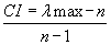 (1) (1) |
| |
| The consistency of a pairwise matrix can be interpreted as shown on table 3. In our case, the overall consistency was = 0, thus the pairwise matrix was proved to be consistent enough.To derive the exact weighting for each parameter, we raised the matrix to large powers and summing each column and dividing each by the total sum of all the columns, or approximately by adding each column of the matrix and dividing by their total. The total weight of the entire factors must add up to 1 and range from 0.01-1. |
| |
| |
| |
| The final integration of input parameter maps used the index overlay model and provided the agro-ecological zones of Masvingo Province. The index overlay formulae used summed up all the input parameter maps after each had been multiplied by its overall weighting. |
| |
| Results |
| |
| Figures 1and Figure 2 show the suitability maps in terms of agricultural production of the individual input parameters. The parameter names of maps shown on figures 1 and figures 2 are shown on table 4. |
| |
| |
| |
| |
| |
| |
| |
| The overlay model used to derive the final AEZs is given below; Masvingo AEZ = [(Length of growing period* 0.09) + (Probability of receiving more than 500mm between October to April*0.14) + (Probability of receiving more than 700mm between October to April *0.07) +(Slope gradient classes * 0.01)+ (Soil types *0.06) + (Soil depth* 0.03) + (Percentage of land eroded by water *0.03) + (Soil moisture index *0.08 )+ (Altitude*0.1) +( Proximity to water bodies*0.14) +(Average Maximum Dry Spell *0.08) +(Average Number of Dry Spells*0.12)+ (Coefficient of deviation ofAverage Maximum Dry Spells*11) +(Land cover* 0.01)+ (Ecological community* 0.03)]. |
| |
| The coefficient multiplying each input parameter is its weighting; the higher the value then the more weight that parameter carries. |
| |
| |
| Figure 3 shows the AEZs derived from the afore-mentioned overlay model. The northern districts of the province show the greatest potential in terms of agricultural suitability, most likely because they receive high rainfall as well as their proximity to water bodies. Mwenezi and Chiredzi districts are the most marginal in terms of agricultural production.The moderate portions in these districts are so because of irrigation potential in terms of their proximity to water bodies. |
| |
| |
| |
| Unsuitable land covers the least number of hectares (table 5), implying that, potentially the province can adapt to the negative impacts of climate change. For most of the land under suitable to moderate agricultural potential, irrigation from the available water bodies is the key to mitigating the negative impacts of climate change. |
| |
| |
| |
| A comparison of the new AEZs for Masvingo with those of Vincent and Thomas [5] shows some degree of shift and patchiness in the regions of agricultural (Figure 4). Some areas previously in the category of agricultural marginality (region 4) have been classified as suitable on the new AEZs because of proximity to water bodies, a factor not considered by the former. Some area in the extreme northern parts of the province have shifted from being suitable in region 3 to the moderate zone on the new AEZs, this might be a factor caused by climate change and climatic variability. |
| |
| |
| |
| Recommendations |
| |
| The greatest potential of Masvingo province in the fight against climate change is in its water bodies which are by and large perennial and among the largest in terms of capacity in Zimbabwe. This therefore means that plans need to be put in place to develop low cost but sustainable and effective irrigation technology to be used by the farmers in the province. |
| |
| The other potential is that most the land classified as suitable 1 390 782.75 hectares and moderate 2 792 404.89 can be ploughed three times a year under suitable irrigation technology (except for high altitude areas were winter frost can occur). This has the potential to make farmers in the province financial stable making them self-capable of investing in better technology for them to cope with climate change. |
| |
| Without the careful use of these water bodies, any strategies meant to improve the resilience of the province to climate change is most likely to fail. The list of agricultural activities recommended for each agroecological zone is listed on Table 6. |
| |
| |
| |
| As a way forward, there is a need to have an intensive study into the ground water potential for the Province.The advantage of ground water is that is offers a relatively cheap and quick temporary cushion to the local farmer from the negative impacts of climate change, while the more permanent solution of developing irrigation infrastructure is being planned and implemented most likely on a stage by stage basis. |
| |
| |
| References |
| |
-
|
| |
| |