Research Article Open Access
Resettled Wellbeing And Biological Impact Analysis: A Case Of Padampur Village Development Committee In The Chitwan National Park, Nepal
Hari Datt Joshi*Environmental Health Research Officer, Nepal Health Research Council, RamshahPath Kathmandu, Nepal
- *Corresponding Author:
- Hari Datt Joshi
Environmental Health Research Officer
Nepal Health Research Council
RamshahPath Kathmandu, Nepal
Tel: +1977-9841721687
E-mail: sahara.hari@gmail.com
Received date: May 09, 2013; Accepted date: July 10, 2013; Published date: July 12, 2013
Citation: Joshi HD (2013) Resettled Wellbeing and Biological Impact Analysis: a case of Padampur Village Development Committee in the Chitwan National Park, Nepal. J Ecosys Ecograph 3:130. doi:10.4172/2157-7625.1000130
Copyright: © 2013 Joshi HD. This is an open-access article distributed under the terms of the Creative Commons Attribution License, which permits unrestricted use, distribution, and reproduction in any medium, provided the original author and and source are credited.
Visit for more related articles at Journal of Ecosystem & Ecography
Abstract
There is insoluble dilemma between biodiversity conservation and poverty reduction. This dilemma directly arises in park creation programs, when intended park areas are inhabited by poor indigenous people. There has been a complex structure to maintain double sustainability principle, i.e., sustainability in conservation and livelihood. The present study was carried out in Padampur relocated village at Barandabhar Corridor area of Chitwan National Park, Nepal to understand the wellbeing of the relocated people. The relocation project was people initiated rather than forced population displacement. Random quadrates sampling were adopted for biological impact analysis and detailed interviews were taken through the conceptual lens of the Impoverishment Risk and Reconstruction model (IRR model) for analyzing the livelihood of peoples (two stage, snowball without replacement random sampling). After resettlement program, it has shown some improvement of livelihood of people. However there were some constraints in using traditional resources, culture and knowledge which are troubling to indigenous Tharus. Similarly, shortage of water and low productivity are obstructing the day to day work of resettled people. There was a need of strong management policy for conservation of biological element at relocated place, particularly in Barandabhar Corridor forest.
Keywords
Impoverishment Risk and Reconstruction model (IRR model); Double sustainability principle; Livelihood; Conservation; Resettlement and Bharandabhar Corridor community forest
Introduction
There have been several cases of conservation initiative project affecting the livelihood of people, in particular indigenous communities. In the past, biodiversity conservation practices have been uniformly biased towards conserving biological resources, while undermining people’s needs [1]. Conservation related resettlement programs are judged largely unsuccessful, due to people’s opposition to move from their original place, especially in the case of tribal and indigenous people. In some cases, environmental resettlement programs have been positive with respect to income, off-farm employment and access to infrastructure, but failed to provide people’s participation in making decisions [2]. It is also important to understand people’s self determination, i.e., whether they want to get away from the recurrent hardships caused by natural hazards and disturbances from park wild animals or stay at their original residence and strategize for a better living [3].
There is significant difference between voluntary and forced resettlement respondents in overall satisfaction as well as evaluation of land quality and employment factors. Though this study does not show any difference in their evaluation of land ownership, housing, physical infrastructure, health, social ties, and support services as having positive outcomes. Almost all respondent are being socially and economically better off in the new location. But these studies have limitation on in-depth study of project impact on exiting biodiversity status [4]. Land equity on population has always indicates good relationship on socio-economic factors as well as other direct and indirect impact factor. The relocation and resettlement of people from nature reserves is a controversial issue in the conservation community. On this study about 71% of households were satisfied with the relocation effort and their quality of life in 2002 and 52% of households were satisfied with their quality of life. Four years after relocation, all households have access to electricity, water, schools, and health care, transportation, and communication facilities. Many households have increased their income and assets. Yet, there were differences between the two different resettlement villages, with one of them faring better in terms of economics, hardships, and uncertainty [4,5].
The objective of this paper is to evaluate the impacts of resettlement on the wellbeing of Padampur community, how people perceive the government led planning, whether the planned scheme helped people in solving their problems, those they were suffering in the old location. Similarly, this research compared household well-being in the new and the old site. How people perceive the whole resettlement program in terms of their livelihood opportunities or threats. Resettlement theory argues that key variable require the evaluation of land ownership, job opportunities, economic wellbeing, social articulation, marginalization, differential impacts and conservation impacts [1]. Moreover, this research also tried to shed light on biodiversity impact due to resettlement program on corridor forest through calculating expected vegetation loss and exploring locals’ views on the status and effect on wildlife migration at corridor.
Historical Background of Chitwan
World Health Organization (WHO), in 1951 initiated malaria eradication at the same time resettlement program was hormonally encouraged hill people to resettle in the highly fertile lowlands. Due to this cause increase in the population of Chitwan and the Terai as a whole was primary cause of forest degradation in Nepal from 150s to late 1980s [4,6-9]. Hence during this period, project exacerbating the big problem on natural biodiversity terai vabar churia range of Chitwan. That problem ultimately changed the government strategy for conservation of natural resources in this area. As a result, the Park was established in 1973 [4,10] and recognized as a World Natural Heritage Site in 1984 [4,11]. The Park is situated in south central Nepal; its area was 544 km2 at the time of the declaration and later expanded in 1977 to 932 km2 (core area) in the subtropical lowlands of the inner Terai. Prior to the establishment of the Park there had been 26 village clusters, but all were removed forcefully with the exception of old Padampur, a cluster of 16 smaller villages. The reason old Padampur was not resettled prior to the Park formation was mainly due to the valid land titles held by villagers, as well as the political influence of the Tharu landlords [4].
Biological Significance of the Park
Floral diversity encompasses more than 600 species, of which 50 are grasses [12]. The typical vegetation of inner Terai is subtropical broadleaf forests with predominantly Sal tress covering about 70% of national park area. Along the southern face of churia hills Sal is interspersed with chir pine (Pinus roxburghii) On northern slopes sal associates with smaller flowering tree and shrub species such as Beleric (Terminalia bellirica), Rosewood (Dalbergia sissoo), Axlewood (Anogeissus latifolia), Elephant Apple (Dillenia indica), Grey Downy Balsam (Garuga pinnata) and creepers such as Bauhinia vahlii and Spatholobus parviflorus. An ever-changing mosaic of riverine forest and grasslands along the river banks deposited alluvium and in lowland areas groups of Catechu (Acacia catechu) with Rosewood (Dalbergia sissoo) predominate, followed by groups of Kapok (Bombax ceiba) with Rhino Apple trees (Trewia nudiflora), the fruits of which rhinos savour so much. Understorey shrubs of Velvety beauty berry (Callicarpa macrophylla), Hill Glory Bower (Clerodendrum sp.) and gooseberry (Phyllanthus emblica) offer shelter and lair to a wide variety of species. Terai-Duar savanna and grasslands cover about 20% of the park’s area. More than 50 species are found here including some of the world’s tallest grasses like the elephant grass called Saccharum ravennae, Giant cane (Arundo donax), Khagra reed (Phragmites karka) and several species of true grasses. Kans grass (Saccharum spontaneum) is one of the first grasses to colonize new sandbanks and to be washed away by the yearly monsoon floods [13]. The global biological significance of Park is because it has the world’s highest density of tigers and probably the second highest density of one-horned rhinoceros [14,15]. In addition, Chitwan is considered to have the highest population density of sloth bears with an estimated 200 to 250 individuals. Smooth-coated otters inhabit the numerous creeks and rivulets. Golden jackals are common. Bengal foxes, Spotted linsangs, palm civets, large and small Indian civets, several species of mongoose, honey badgers and yellow-throated martens roam the jungle for prey. Wild dogs are rare. Striped hyenas prevail on the southern slopes of the Churia Hills [16] The Park supports 50 species of mammals, 526 species of birds, 49 species of reptiles and amphibians, and 120 species of fishes [4,12]. In this regards Chitwan National Park is ecological significant and need to be well it’s covered land area, must be protective and peoples equity common resources which continuously and automatically coming from National Parks.
Study Area
The old Padampur village lies within the Chitwan District, one of the most populous districts of Nepal due to its immense biological and economic resources. The Chitwan District extends from the low land Bhabar area to the Mahabharata Mountain range, a change in elevation from 141 to 1945 m. The old Padampur Village Development Committee was the only remaining enclave in the Chitwan National Park and was relocated in 2005 to another area about 20 km north of the Park, named as New Padampur along Bharandabhar corridor forest of Chitwan National Park within the Chitwan District. The village was facing numerous challenges those caused by the strict rules and regulations of the park and the natural calamities. Out of many challenges one of suffering challenge was conflicts among wildlife and human. In one study a few villagers nearest to the park reported that in some years 80 to 90% of all their crops were lost due to grazing by wild animals. As a result, farmers responded by abandoning farming near the park boundary [4,17]. Among the many challenges it faced were relentless flood from the Rapti River during monsoons and severe animal and crop depredation, especially by rhinoceros and tigers. In 1993, for the first time, major flooding had a devastating impact on the agricultural land of the entire Padampur VDC. Faced with unproductive, sand covered fields and the prospects of similar future floods, local initiative was established to request government help in resettling. Although resettlement debate initiated since 1964, it was finally resettled voluntarily in 2004.
Materials and Methodology
A descriptive cross-sectional comparative study was carried out on resident wellbeing and biological impact analysis at relocated Padampur Village Development Committee (VDC) of Chitwan district, central Nepal. Resettled wellbeing analysis was analyzed through social survey, while biological impact analysis was analyzed by both social and vegetation survey. The household sample size was determined as 72 by using standard statistical formula with reference to Population census of 2001 and population survey conducted by the New Padampur VDC. There were 2316 households which were resettled in location, New Padampur.
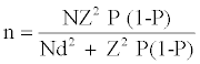
Where, n = sample size
N = total number of households
Z = confidence level (at 95 % level Z = 1.96)
P = estimated population proportion (0.05, this maximize the sample size)
d = error limit of 5 % (0.05)
Two stages of sampling process were adopted for selection of households. All nine wards were selected purposively during first stage of selection. From each selected wards, households were selected randomly at second stage. The selection of household was devised with probability proportionate to sample size for all wards on the basis of land occupied by landowner. The sampling protocol for selecting 72 households was carried out by lottery method in each ward without replacement. Standardized Impoverishment Risk and Reconstruction (IRR) model questionnaire with some modification was applied as research tool for the collection of primary information. The model highlighted eight anticipated variables: landlessness, joblessness, and homelessness, and increased morbidity, loss of common property, marginalization, and social disarticulation. The model suggests that if the predictable variables are not minimized after resettlement, one may observe increased impoverishment. In this study, we had compared people’s wellbeing with reference to each risk in the old location and the new location in order to understand people’s self-evaluation in the context of changed environment. The semi-structured questionnaire was applied to each selected household’s representative head by face-to face interview. Before conducting interview each selected households were pre-informed through social mediator for participation on the voluntary research work, if any one did not want to participate then protocol was repeated for selection next household. Biasness posed by the non-response was tried to minimize through different research norms.
While for vegetation survey, Global Positioning System (GPS) points of outer boundary line of resettled village and its adjacent forest boundary were noted (GPS model: Etrex Garmin, USA). Since the biological impact is more intense on proximate forest to settlement area, vegetation survey was limited to one kilometer inward of forest from boundary line of resident and forest. The boundary map (Figure 1) of the resident area and forest was prepared by using Arc- GIS. Altogether 25 random sampling plots were generated (Random Sampling Method) inside forest. Each sampling plot was measured through quadrate method. To check any inconsistency and ensure validity a standard calibrated instrument were used in the field study. Secondary information was collected from national and international scientific journals and reports. The collected data from the field were all sorted as per the different categories. The local units were converted into standard units [18]. Then the data were analyzed and interpreted with the help of Microsoft Excel and Statistical Program for Social Sciences (SPSS). To check the reliability of research questionnaire, it was pre-tested (15 households) in same village with applying same methodology.

Figure 1: Map of Chitwan, Nepal, and locations of the new Padampur and the old Padampur.
Result
A survey among 72 households revealed a total of 2310 population with average family size 6.45 per household having sex ratio 1.08:1 (M:F). Ethnically the community was heterogeneous with higher percentage comprised by Tharu (37.5%), followed by Janajati (29.2%), Brahmin (19.4%), Dalit (8.3%) and Chhetri (5.6%). Literacy was found poor in the studied community, in that also only few advantageous group such as Brahmin/Chhetri (25%) had higher literacy percentage, while disadvantageous group like Dalit had only mere 8.3% literacy.
Moreover, socioeconomic wellbeing indicator was judged by applying Impoverishment Risk and Reconstruction (IRR) model on the basis of people’s perception of their recent socioeconomic changes since the completion of the resettlement process. Data revealed that, the farm size was reduced after relocation, which remained 0.5032 ha per capita landholding in new location from 0.799 ha per capita landholding in old location. The land hold number in small land size (<0.204 ha.) and medium land size (>0.62ha to <2.62ha) were increased by 23.61% and 7.71%. Similarly, the landholder number in large farm size (<2.62ha.) and very large farm size (> 2.62ha.) was decreased by 12.61% and 19.44% as given in Figure 2.

Figure 2: Land holding categories of sample households.
The monetary compensation of land was received by 52% HH (those who had more than 2.6 ha in previous place). The compensation was effectively utilized in different sectors like construction, bank balance which was very good practice and can help in minimizing impoverishment. The food production was decreased by 31.9% because deficit of land than previous. Among 72 household, 56.9% responded about deficit in paddy production and 34.7% and 59.7% told that wheat and pulses were found to be inadequate production in New Padampur. As perceived by responded old Padampur was good for agricultural production due to alluvial soils. Responded reported that the deficit of food was largely met by purchase in market. In the new location, households ought to work out of the farm due to their less landholdings size and its deficit production. Some people believed that they are more mobile after shifting in new Padampur due to access to road, which made it easier to find jobs and to involve in income generating skills. Most people were involved in skilled and unskilled occupation and 69% respondents were satisfied with their present occupation and 25% did not feel any difference for their current job but remaining 6% sample respondents were positive toward previous occupation rather than present. In every informal discussion, women participants expressed their feeling with enthusiasm that new settlement is very good for women. More spare time due to less agricultural work hour in new location has allowed women to learn new skills and gain more education. Women’s skill training programs include bee keeping, mushroom farming, animal rearing, fruit farming, wool spinning and vegetable farming.
Due to proximity to Bharatpur municipality people received better health facility, emergency medical service, child immunization, family planning and other medical service. More than eighty percentage of responded reported that new location has better healthcare facilities. The percentage distribution is shown in Figure 3. In addition, some Tharu people were still practicing their traditional healing methods with the Gurau. People also perceived, other health related activity like improved sanitation practice. Research team also observed good practice of utilization and management of toilets in every household, where more than 95% HH had toilet among which 46% HH had modern toilet. Almost every sample had good practice of waste management. Shortage of drinking water was major problem in the new settlement which could however impede other health related consequences.

Figure 3: Health service before and after relocation.
The physical infrastructure was found well planned and very systematic. Household respondents confirmed that public physical infrastructure in new location was better. More than 56% sample population said, present physical infrastructures and there planning were very good and remaining other respondents were also found satisfied to them.
In old Padampur, most of the people had houses made of thatch, mud and timber, however in new location, more than 58.3% houses were made of cement and concrete, and remaining 41.6% by mud, thatch and timber. In terms of both housing and land tenure, the people in new Padampur experienced more security than in the old location.
Forced displacement can result marginalization and can affect physically and psychologically but Padampur relocation program was completely voluntary. According to official record of the Padampur Village Development Committee, the landless families also received land after the resettlement. On this account, marginalization was reduced. Land was more equally distributed due to the land compensation threshold set by the Relocation Commission. The minimum area of land-to-land compensation was one Bigha (0.625 ha.). The bigger landholders became smaller landholders. The gap between landlords and tenants was reduced due to this mechanism that shifted the village towards greater equity. For larger land owners who did not invest their compensation funds wisely, there was also a chance of increased marginalization. As per information, Tharu, are the major marginalized indigenous ethnic groups in cultural and resource utilization practice. The Tharu community had more attachment with the forest for collecting minor forest products such as forest fibers, wild fruits, medicinal plants and aquatic food sources such as fish and shells from the river which was the important economic activities for Tharu households in old Padampur.
Clean energy utilization practice was not developed at old Padampur resident inside Chitwan National Park. After relocation there was high utilization of alternative energy like electricity, biogas, liquefied petroleum gas and other in supplement of fuel wood. About 84.47% household was supplied with electricity and 36.11% household had installed solar energy. This practice could be in support of forest conservation at new site. The detail percentage utilization of energy used before and after settlement has illustrated in the Figure 4. The residents were highly dependent upon natural resources in the old locations. Padampur residents realized the potential scarcity of natural resources at the new site and valued the adjacent forest resources. The present demand of fuel wood energy for cooking purposes was 320 kg/ month/household but their supply was only 170 Kg/month/household (1.2$/100 kg).

Figure 4: Comparative study on Energy utilization system for cooking purposes.
Conflict with park people was major problem in previous village. The conflict is analyzed in terms of comparison with crop damage, livestock loss, property loss and human loss, which has shown detail below Figure 5, this is only percentage of population perceived this type of conflict. For example, 2.77% of sample population perceived there was lost human in old Padampur where as in new location there did not occurred human loss (0% loss of human).

Figure 5: Park people conflict before and after relocation.
The occurrence and occurrence frequency of wild animal in the crop land was decrease in relocated area.
Some villagers perceived, the general behavior and migration pattern of wild animals have continuously decreased at Barandabhar Corridor community forest - movement of animals from Northern Mahabharata range to Southern Chitwan national park and vice-versa. The community people perceived that habitat loss, human interference, poaching and natural deaths are the major cause for the reduction of wild animal migration. Out of these poaching was found to be a major issue. However, the forest management community said that forest is playing a vital role in promotion of livelihood of people. The major problems of Baranda Bahar Community Forest at new Padampur VDC were haphazard grazing and timber collection practice. Status of forest was analyzed by computing different index of plant distribution as shown in Table 1.
| Parameters | Tree stratum | Shrub stratum | Herb stratum |
|---|---|---|---|
| No. of species | 12 | 23 | 33 |
| Total number of individual | 273 | 812 | 924 |
| Density/ha. | 398 | 9912 | 119200 |
| Shannon diversity index | 0.93 | 1.2 | 1.44 |
| Species evenness | 0.83 | 0.88 | 0.95 |
| Species richness | 2.0 | 2.39 | 2.65 |
Table 1: Diversity index at tree, shrub and herb.
To calculate predictable loss of plant from deforestation area, vegetation occurrence per hector was calculated from adjacent Barandabhar corridor community forest. Total deforestation land in Barandabhar corridor forest was found to be 1224 ha. Vegetation analysis revealed that anticipated loss of tree strata, shrub strata and herb strata, in one hector was found to be 398 no/ha, 9912 no/ha and 119200 no/ ha, respectively. Thus, it was calculated that in total 1224 ha deforested area the loss of tree strata, shrub strata and herb strata were projected to be 487152 no/ha, 1213288 no/ha and 145900800 no/ha, respectively. The Detail loss of plant species with its frequency, density, diversity and other mathematical calculus has been presented in annexure.
Discussion
The average family size was 6.48 per household which is higher than national average [19]. More than ninety five percent populations rely on subsidence agricultural while unskilled wage labor was major earning source. After relocation, household with small farm size (<0.2 ha) increased by 26%, medium farm size (0.2-0.68 ha) increased by 8.3% and large farm size (0.68-2.7 ha) decreased by 12.5% and very large farms (>2.78 ha) decreased by 19.5%. This implies that land holding of household remarkably diminished after relocation. Moreover, household received land, which had not land title before relocation. People felt the social security because of receiving land in voluntary resettlement [1]. The government paid 50% cash of remaining land to those who had land more than 2.78 ha in previous location [20]. However, people perceived monetary compensation was biased; furthermore most of people realized that monetary compensation was not utilized in productive task. Cernea et al. [21] also reported the similar result in Congo that monetary compensation virtually biased in resettlement project. People perceived that land quality of Padampur relocated area was infertile compared to their previous settlement i.e. Old Padampur though resettlement project claimed that the government provided sufficient productive land to relocated resident [22]. There was reduced (50%) production of seasonal cereal grains such as rice, pulses and wheat in new place in comparison to previous location. But local perceived maize and other cash crop production was high as compared to old Padampur.
More than 50% population household perceived deficit in nutrition. The food deficit is directly related to household size and land holding capacity. The reason behind it may be due to natural things, more people needs more amount of food supply and large land can produce more food. They were involved in skilled and unskilled labor wage on monthly basis or daily basis in the Sauraha tourist spot and Bharatpur town that may be supportive for fulfill of food deficit. But there was not such type of income source in previous location due to remoteness and people were depended on subsistence agricultural economy. And another important income generation source in new Padampur is easy access to the marketing of cash crop and vegetable. Access to transport and market has significantly helped the people to uplift their socioeconomic status and eventually to upgrade their livelihood [23]. The livelihood of peoples at Jivanpur has changed from their traditional occupation to new one after construction of Bhimdunga-Lamidanda road in Dhadhing district. More than forty percent people established grocery, twenty seven tea shops and twelve percent household found fertilizer shop. Cereal grain production was decreased by 82.7% but cash crop and vegetable production was increased by 83.3%. [24,25]. This change was due to easy access of marketing to Kathmandu. But involuntary resettlement program of Khaptad National Park and Shuklaphanta wild life reserve have intervene the traditional economy of that part and no any further improvement was observed on people’s livelihood [26,27].
Most of the displacement and rehabilitation project of developing countries of Asia was unscientific and most of the physical infrastructures for their basic needs were not supplied [1], however infrastructures like concrete road, health facility, education, was well constructed in Padampur. Similarly, most of the respondents reported that housing facility was well set up; moreover they experienced more secure than in previous location. But inadequate water supply was major problem in the resettled community. More than fifty percent population doesn’t have access of clean drinking water. However there was sufficient drinking water in previous location because of easy accessibility to Rapti River.
People perceived that there were many challenges in old settlement. Many people used to loss their life due to lack of basic health services. One of top most hurdles was Rapti River. People usually could not cross the inundated river during rainy season and had to rely on traditional medicinal practices. However, in new location locals were getting better health service as new location is proximate to Bharatpur municipality. Furthermore, architectural design of new location is fortified with public sanitation practice. It is interesting finding that Tharu people had still followed the traditional healing practice to treat several diseases. It is good practice in the ecological term for maintaining and preserving indigenous knowledge and practice. However, they lacked proper herbs and other traditional medicine as in old location. Current finding suggests that there was cultural shift in Tharu community in new location. The young Tharu generation liked to imitate every new cultural environment that relocated community have highly articulated, however, cultural communities are fragmented but interpersonal ties have increased [10,28].
The present study indicates that Barandabahar community forest is dominated by poor quality of fire wood. There is unsustainable supply of forest product as compared to demand of relocated people. Social survey has shown that there is lack of continuous supply of required forest product in contrast there was sufficient amount of forest product in previous location.
There was no supply system of firewood to the families in previous location and people used to collect fuel wood according to their need. But after relocation, the fuel wood demand calculated was 320 kg/ month for a family but the supply was only 170 kg/month/family by charging Rs. 50/100kg. Patterns of energy utilization have been shifted towards alternative energy at new location. Cent percent resident were found depended upon traditional fuel wood in the previous location [29]. But in new location the alternative energy utilization along with fuel wood and LPG were 19.44%, fuel wood with biogas 13.88%, fuel wood plus LPG with biogas 2.77% and only LPG 5.55%. Alternative energy utilization is high as comparison to district and national level [20].
People perceived the combustion of higher ladder of energy will be better for healthy life. They said, they were feeling somewhat less burden of indoor air pollution and its vulnerability as compared to old location. However there is no any appropriate health statistics which could reveal the reduction of indoor air pollution. But research has proved that higher ladder of energy combustion have improved the livelihood of people [30].
Park people conflict is regarded as a part of wellbeing indicator. Sadistic type of conflict may drop the quality of life but friendly conflict will be helpful for the betterment of quality life. About 30% domestic cattle were killed by tiger and 10% to 100% crops were damaged depending upon human settlement nearer to park in previous location where park people conflict was frequent around national park and 60 people were killed [17,31]. After relocation park people conflict was insignificant but some crop damage was occurred around the park area. People reported four endangered Asian one horned rhinoceros (Rhinoceros unicornis) were found dead in Barandabhar community forest. People also reported frequent rhino visit in this forest and poacher have now easy access for killing and supplying animal parts. They also told that there is high dominance of Trewia nudiflora, and called Rhino Apple trees, which is the most preferred food of rhino. Barandabhar community forest is also migration path for wild animal from where wild animal migrate from south part to north and vice versa. The people perceived that there was continuously decrease in general occurrence and frequency of migration pattern of wild animal. The reason for it could be due to habitat loss, human interference on corridor and high poaching activities, matching conclusion has drawn by Martin EB [32].
Conclusion
The descriptive result was based on the perception of local people with their insightful information about impact of resettlement program in livelihood and forest resources that could be incorporated in decision-making process and lead to forest conservation and livelihood promotion. However, few tharu people were marginalized, the finding indicates that there were increased social security, employment opportunities, health facility, and social ties. The shrinkage of fuel wood resource, decline in food production, and shortage of water in new location were regarded as major problem but alternative energy becomes a chief source of living, which is good indication of healthy life and clean environment. The voluntary resettlement project of Padampur has shown people’s livelihood prop up rather than obstructive like as other involuntary of national and international-Asia and Africa [33-40]. The foremost drawback of resettlement project was Corridor forest deforestation, where, more than 1224 hector forest were deforested. Now, the human interference is threatening in ecology of wild animal, therefore public concern should be mentioned for proper management of forest to enhance the locally available resources.
References
- Cernea M (2000) Impoverishment Risks, Risk Management and Reconstruction: A Model of Population Displacement and Resettlement. In: Cernea M, Christopher M (2000) Risks and Reconstruction: Experiences of Resettles and Refugees. The World Bank, Washington DC, USA.
- Dickinson D, Webber M (2004) Environmental Resettlement and Development on the Steppes of Inner Mongolia, PRC. The Journal of Development Studies 43:537-561.
- Schmidt–Soltau K (2003) Conservation Related Resettlement in Central Africa: Environmental & Social risks. Development and Change 34: 525.
- Dhakal NP, Nelson KC, Smith JLD (2011) Assessment of Resident Wellbeing in the Padampur Resettlement, Chitwan National Park, Nepal. Society and Natural Resources 24: 597- 615.
- Karanth KK (2007) Making Resettlement Work: The case of India’s Badra Wildlife Sanctuary. Biological Conservation. 39: 315-324.
- Ghimere K (1992) Forest or farm? The politics of poverty and land hunger in Nepal. Oxford University Press, New Delhi, India.
- Singh ML (1984) Comparative evaluation of planned and unplanned resettlement in Nepal. Kathmandu, CEDA, Tribhuvan University, Nepal.
- Elder JW, Ale M, Evans M, Gillespie DP, Nepali RK, et al. (1976) Planned resettlement in Nepal’s Terai: A social analysis of Khajura/Bardia Punarvas Project. Tribhuvan University Press, Institute of Nepal and Asian Studies, Kathmandu, Nepal.
- Gee EP (1959) Report on a survey of the rhinoceros area of Nepal. The International Journal of Oryx 5: 59-85.
- Sharma UR (1990) An overview of park-people interactions in Royal Chitwan National Park, Nepal. Landscape Urban Plan 19: 133-144.
- Mishra HR, Jeffries M (1991) Royal Chitwan National Park: Wildlife Heritage of Nepal. The Mountaineers, Seattle, USA.
- DNPWC (2009) Annual Report (2008-2009) The Status and Distribution of the Greater One-Horned Rhino in Nepal, Kathmandu, Nepal.
- Shrestha BK, Dangol DR (2006) Change in Grassland Vegetation in the Northern Part of Royal Chitwan National Park, Nepal. Scientific World 4: 78-83.
- Dinerstein E, Rijal A, Bookbinder M, Kattel B, Rajouria (1999) Tigers as neighbors: Efforts to promote local guardianship of endangered species in lowland Nepal. In: Seidensticker J, Christie S, Jackson P (1999) Riding the tiger: Tiger conservation in human-dominated landscapes. Cambridge University Press, Cambridge, UK.
- Smith JLD, McDougal C, Ahearn SC, Joshi AR, Conforti K (1999) Metapopulation structure of tigers in Nepal. In: Seidensticker J, Christie S, Jackson P (1999) Riding the tiger: Tiger conservation in human-dominated landscapes. Cambridge University Press, Cambridge, UK.
- Jnawali SR, Baral HS, Lee S, Acharya KP, Upadhyay GP, et al. (2011) The Status of Nepal’s Mammals: The National Red List Series. Department of National Parks and Wildlife Conservation, Kathmandu, Nepal.
- Milton JP, Binney GA (1980) Ecological Planning in the Nepalese Terai: A report on resolving resource conflicts between wildlife conservation and agricultural land use in Padampur Panchyat. Threshhold International Center for Environmental Renewal, Washington DC, USA.
- Nepal SK, Weber KE (1992) Struggle for Existence: Park People Conflict in the Royal Chitwan National Park, Nepal, Studies in Regional Environmental Planning, Division of Human Settlements Development, Monograph 28, Asian Institute of Technology, Bangkok, Thailand.
- DNPWC (2001) Annual Report (2000-2001) Department of National Park and Wildlife Conservation, Kathmandu, Nepal 2005. 25 years of commitment to conservation Facts file (1980 to 2005).
- Go N (2008) Decentralized Rural Infrastructure and Livelihood Project. Ministry of Local Development (MoLD), Department of Local Infrastructure Development and Agricultural Roads (DoLIDAR), and 18 District Development Committees (DDCs), Kathmandu, Nepal.
- Cernea MM, Schmidt-Soltau K (2006) Poverty Risk and National Parks: Policy Issues in Conservation and Resettlement. World Development 34: 1808-1830.
- UNESCO-IUCN (2003) UNESCO - IUCN Enhancing Our Heritage Project: Monitoring and Managing for Success in Natural World Heritage Sites Initial Management Effectiveness Evaluation Report: Royal Chitwan National Park, Nepal.
- Dhungel H (1998) Risk and Rewards of mega projects: The political economy of Paraguan Hydropower. Water Nepal 7: 19-48.
- Timallsina KP (2003) A master thesis on Ipact of Bhimdhunga-lamidanda road on livelihood Strategies of rural people: A case study of jivanpur VDC, Dhading District, Central department of Geography Tribhuvan University Kritipur, Kathamandu.
- Khanal M (1995) Tourism in Nepal: A case study of Sauraha Master level thesis submitted to Department of economics T.U. Nepal.
- Gurung H, Dagfin L (1989) Review of Policy and Experiences of Project Related Resettlement in Nepal. Water Nepal 1: 4.
- Pant B (2007) Impact of human relocation program on rural livelihood: a case study from shuklaphanta wildlife reserve, Nepal. Department of Forest, Tribhuwan University, Pokhara, Nepal.
- Robinson JG (2006) Conservation Biology and real-world conservation. Conserv Biol 20: 658-669.
- McLean J (2000) Conservation and the impact of relocation on the Tharus of Chitwan, Nepal. Himalayan Research Bulletin 19: 38-44.
- Joshi HD, Pandeya R, Dhakal B (2009) Health impact of indoor air pollution. J Nepal Health Res Counc 7: 69-75.
- McDougal C (1989) Tiger attacks around Chitwan National Park. cat News 11: 13.
- Martin EB (2004) Rhino poaching in Nepal during an insurgency. Pachyderm 36:87-98.
- Boeker M (2000) State interventions in Chitwan: on the historical development of a region in southern Nepal. Geography & travel, Zurich Open Repository and Archive 5: 175-200.
- Brockington D, Igoe J, Schmidt-Soltau K (2006) Conservation, human rights, and poverty reduction. Conserv Biol 20: 250-252.
- Cernea MM, Schmidt-Soltau K (2003) Biodiversity conservation versus population resettlement: Risk to nature and risks to people. International Conference on Rural Livelihoods, Forest and Biodiversity 19-23 May 2003, Boo, Germany.
- Rawal SR (1995) The Gir National Park and the Maldharis: Beyond Setting Aside. In: West PC, Kai SS (2003) Resident Peoples and National Parks: Social Dilemmas and Strategies in International Conservation. Conservation Related Resettlement in Central Africa: Environmental & Social risks. Development and Change 34: 525.
- Mishra HR (1982) Balancing human needs and conservation in Nepal’s Royal Chitwan National Park. Ambio 11: 246-252.
- Paudel NS (2002) Integrating People and Nature: A perspective for Environmental Conservation and livelihoods in the context of Nepal. Journal of Forest and Livelihood 2: 62-67.
- Shrestha MK (1994) Resource use and plant ecology of Shivapuri Watershed and Wildlife. In: Summer LW (1996) Welfare, happiness, and ethics. Oxford: Claredom Press Reserve. University of Wisconsin, USA.
- Smythies EA (1944) Big game shooting in Nepal. Calcutta, India. In: West PC, Brechin SR (1991) Resident peoples and national parks: Social dilemmas and strategies in international conservation, University of Arizona Press, USA.
Relevant Topics
- Aquatic Ecosystems
- Biodiversity
- Conservation Biology
- Coral Reef Ecology
- Distribution Aggregation
- Ecology and Migration of Animal
- Ecosystem Service
- Ecosystem-Level Measuring
- Endangered Species
- Environmental Tourism
- Forest Biome
- Lake Circulation
- Leaf Morphology
- Marine Conservation
- Marine Ecosystems
- Phytoplankton Abundance
- Population Dyanamics
- Semiarid Ecosystem Soil Properties
- Spatial Distribution
- Species Composition
- Species Rarity
- Sustainability Dynamics
- Sustainable Forest Management
- Tropical Aquaculture
- Tropical Ecosystems
Recommended Journals
Article Tools
Article Usage
- Total views: 15505
- [From(publication date):
September-2013 - Dec 19, 2025] - Breakdown by view type
- HTML page views : 10734
- PDF downloads : 4771