Research Article Open Access
Livelihood Implications of Redd+ and Costs-Benefits of Agricultural Intensification in Redd+ Pilot Area of Kilosa, Tanzania
Khamaldin D Mutabazi1*, George CK2, Dos Santos AS3 and Felister MM41 Department of Agricultural Economics & Agribusiness, Sokoine University of Agriculture, PO BOX 3007, Morogoro, Tanzania
2 Department of Forest Menstruation and Management, Sokoine University of Agriculture, PO BOX 3013, Morogoro, Tanzania
3 Department of Forest Engineering, Sokoine University of Agriculture, PO BOX 3012, Morogoro, Tanzania
4 Department of Forest Economics, Sokione University of Agriculture, PO Box 3011, Morogoro, Tanazania
- *Corresponding Author:
- Khamaldin D Mutabazi
Department of Agricultural Economics & Agribusiness
Sokoine University of Agriculture
P.O. BOX 3007, Morogoro, Tanzania
Tel: +2550785252550
E-mail: khamaldin@yahoo.com
Received date: November 11, 2013; Accepted date: February 28, 2014; Published date: March 19, 2014
Citation: Mutabazi KD, George CK, Dos Santos AS, Felister MM (2014) Livelihood Implications of Redd+ and Costs-Benefits of Agricultural Intensification in Redd+ Pilot Area of Kilosa, Tanzania. J Ecosys Ecograph 4:144. doi:10.4172/2157-7625.1000144
Copyright: © 2014 Mutabazi KD, et al. This is an open-access article distributed under the terms of the Creative Commons Attribution License, which permits unrestricted use, distribution, and reproduction in any medium, provided the original author and source are credited.
Visit for more related articles at Journal of Ecosystem & Ecography
Abstract
Agriculture is the primary driver of deforestation and degradation. This makes addressing deforesting and degrading agricultural practices highly pertinent in the REDD+ planning and implementation. REDD+ interventions target to mitigate deforestation and degradation by addressing underlying drivers such agricultural expansion into forestland. In tropical Africa, encroachment of forests in search of fertile virgin land has been a common practice. Inevitably, the REDD+ processes will impact on the local livelihoods in different ways – positive and negative. The local-level land use plans promoted under REDD+ are likely to alter how much land a farmer would access and where. Different groups of the poor will be affected differently. Land use alterations will impact on the local food security and food systems at large. In view of such impacts, compensations are made integral of REDD+ programming and delivery. REDD+ projects promote agricultural intensification practices such as conservation agriculture in order to attain higher food production per unit land while mitigating deforestation and degradation. As REDD+ concept is being piloted in the country, we have limited understanding of the livelihood implications of REDD+ interventions. Furthermore, local-scale economic viability of measures used to address drivers of deforestation and degradation such as agricultural expansion is empirically not well understood. This paper is a modest attempt to illuminate the livelihood implications of REDD+ interventions and estimate the economic viability of agricultural intensification practices in the REDD+ pilot area in Kilosa district, Tanzania.
Keywords
Agricultural intensification; Economic viability; Deforestation; Degradation; Agricultural productivity
Introduction
Greenhouse Gas (GHG) emissions from agriculture, including crop and livestock production, forestry and associated land use changes, are responsible for a significant fraction of anthropogenic emissions, up to 30% [1]. Agriculture and charcoal making are the major traditional drivers of deforestation [2].
While the general global deforestation rate showed a decline starting from 2005 that of Sub Saharan Africa including Tanzania is on increase. Tanzania’s forests face enormous challenges, including deforestation and degradation. The current deforestation rate in the country is estimated to be between 130,000 and 500,000 hectares per annum [3]. According to the available research findings [4,5]. Tanzania is ranked the 12th among the countries with the largest forest loss per year in Africa. The deforestation according to Mombo [6] is a result of communities dependence on timber products for their livelihoods. These include the need for biomass for energy purposes resulting from less availability of cheap alternatives, poles for building and income generation for purchase of various processed goods and payments for social services (e.g school fees, hospital bills and clothing).
Besides, the poor farming practices force most of rural communities (which contributes 80% of the total country’s population) to engage in shifting cultivation and concentrate their farming in areas with favourable agro-climatic conditions. These areas happen to be where there are important forests that have specific ecosystem values. Consequently practices that meant to enhance the farmers’ agricultural productivity lead to cutting of trees which are important for sustenance of the ecosystem services. Further to this, Tanzania development policies emphasize investment in agriculture to alleviate country’s poverty, as a result large scale investors come to practice agriculture in rural areas and sometimes buy land from the natives. The natives who are income poor most of the times are attracted to sale their land with the hope that they would solve their cash problems. Contrary to their expectations they come to realise that cash they receive from the sales of their land are meagre to make economic viable projects. Ultimately these farmers are pushed to marginal areas (most of the times forest and bush lands) where they continue with their previous farming practices that lead to deforestation and degradation [7,8]. Reducing deforestation and degradation therefore means slowing down the expansion of agricultural land into forests [9].
National level REDD+ policies and programmes will need to address agriculture as a driver of deforestation and forest degradation, and ensure that local level food security is not compromised to ensure the long-term political and social sustainability of REDD+. Agricultural intensification is at the centre stage of harmonization of agricultural policies and REDD+ policy goals [10].
The agriculture sector and forests are intrinsically linked, most obviously through their direct competition for land. Broad consensus has emerged on three immediate causes of deforestation, all of which influence the profitability of farms and the economic opportunities for farmers. These are higher agricultural prices, more and better roads, and low wages and a shortage of off-farm employment opportunities.
Angelsen et al. [9] views actions that promote intensive agricultural production to contribute to reducing rent of deforesting extensive agriculture hence reducing deforestation related with agricultural expansion.
The farm-level strategies that sustainably improve agricultural productivity are increasingly viewed to be pertinent in REDD+ programming. This reality has motivated the REDD+ pilot project to promote best agricultural practices that would halt the deforestation and degradation rates through accelerated land clearing [11].
Angelsen et al. [9] poses a big question regarding the agricultureforest nexus amid of growing population – how to meet increased food demand arising from higher incomes and concomitant changes in eating habits. Are we then facing an unpleasant choice between “conserving the forests” and “feeding the hungry?” Indeed, profitable agricultural intensification is likely to reduce and not to stop conversion of woodland/forests to farmland. This is because of growing human population creating more mouths to be fed overtime.
This paper explores the livelihood implications of REDD+ interventions on different groups of the rural poor in a REDD piloting area of Kilosa District in Tanzania. Furthermore, the paper analyzes farm-level costs and payoffs of conservation agricultural practices relative to deforesting and degrading “business-as-usual” farming. The findings will illuminate the potential livelihood impacts of REDD+ and the economics of productivity-enhancing agricultural practices that reduce deforestation and degradation.
Conceptual framework
The conceptual framework for this study is based on literature search and personal experience of the authors. In this, the summary of current farming practices referred from now on as Business as Usual (BaU) is elaborated to show how this can be changed into good practises through REDD+ concepts. The resulting changes posit an improved economy that through which the livelihoods of the poor farmers could be enhanced. This anticipated outcome is based on concept of REDD+ architecture. The study’s variables linkages and relationships as elaborated in Figure 1 are explained in the followed texts under this section.

Figure 1: Conceptual Framework.
According to FAO and Rademaekers et al. [12,13] and Angelsen et al. [9], unsustainable practices vested in conventional Businessas- Usual (BaS) farming contribute significantly to deforestation and forest degradation. Examples of such practices include unsustainable cultivation, slash and burn, shifting and low-input systems as presented in Figure 1. Unsustainable farming deforests and degrades the agrolandscapes pushing smallholder land users into the state of poverty and food insecurity. Conservation Agriculture (CA) is seen as a promising appropriate measure for mitigating farming-related deforestation and degradation in fragile tropical agro-landscapes [14]. This reality has motivated the promotion of CA in most of REDD+ pilot projects in various countries including Tanzania.
CA forms a family of practices that work better under different biophysical and socio-economic conditions. According to Shively and Meyfroidt [15,16], intensification in agriculture purportedly creates a “virtuous cycle of poverty reduction and reduced forest pressures,” where it increases yields while limiting expansion, attracts labour away from forested areas, and/or facilitates reinvestment into already degraded lands.CA ensemble includes minimum tillage, mulching, cover crops, pitting, ridging, and terracing. The REDD+ pilot in our case study area promotes minimum tillage and terracing in combination with improved agronomic technologies entailing crop husbandry and use of inputs. These are promoted against the deforesting and degrading conventional farming practices.
Apart from training the farmers on these CA technologies, the project initially supports the Farm Field School (FFS) plot with a “starter pack” covering levelling devices, improved seeds, fertilizer and herbicides. The training and material support are extended through farmer groups under FFS. The best practices learned from the FFS plots are adopted at individual farm plots. It is anticipated that once farmers realized benefits from CA practices they will scale-out the practices – and even go for more robust but costly practices such as bench terraces to enhance farm productivity.
Enhanced farm productivity through CA will halt expansion into the conserved forest under REDD+ arrangements based on the hypothesis that increased agricultural productivity as a result of intensification, small scale subsistence farmers are likely to cultivate less land to fulfil subsistence and cash needs, and therefore reduce pressure on forests, following the Land Sparing Hypothesis1. Although experiences from the southern Amazon and south-east Asia showed that one major deforestation frontiers are currently driven by commercial agricultural expansion [17] followed by intensification of the same [18], the situation for Tanzania would be different due to several reasons. For example, falling labour availability and land productivity due to application of poor technology, dependence on unreliable and irregular weather conditions adversely affect the sector. Small scale farmers practise shifting cultivation by expanding into forests [19,20]. The abandoned fallow however takes many years to regain forest status due to the poor nature of miombo ecosystems which are characterised by poor soil fertility, low moisture and low rainfall.
Therefore, promotion of CA under REDD+ initiatives remains to be the most viable options for improved livelihood and forest conservation. However, the CA practises need to be economically viable in order to attain the mitigation goal while levering sustainable livelihoods of land users. It is imperative to assess the costs and benefits of CA as to iron out its long-term economic viability. This assessment requires data from different REDD+ planning scales – at project/community and farm/household.
Methodology
The case study design
The aim of the study was to undertaken assessment of the costs and benefits associated with CA promoted by REDD+ pilot project. CA is among the REDD+ package mitigation activities agreed with the REDD+ pilot administering organisation – i.e. TFCG/MJUMITA.
It was not possible to advance CA costs into opportunity costs as we lacked historical deforestation in areas where CA is practised.
With the shortfall of determining the opportunity costs it was not possible to estimate the level of compensation landholders would need so that they would be at least not worse-off, and ideally better-off with a REDD+ project which requires them to make changes in their use of forestland and resources.
With availability of data, this work can be taken to another level of estimating the opportunity cost. Furthermore, the assessment of net benefits provides information that can assist the organisation administering REDD project in its design and/or modification of compensation packages and formats.
However, descriptive analyses cover a range of aspects that imply on opportunity costs of forgone forest benefits in the face of REDD+. For a project focused entirely on avoided deforestation and where the agreement precludes any access to forest resources, the landholder is giving up the opportunity to harvest all the usable forest products and to convert the forest to agriculture. On different front, CA adoption will implicitly compensate farmers from lost access to forest products and clearing forest for agriculture. There is motivation for clearing new forests to establish new farms due to high fertility of virgin forestland.
Study area
The project site is in Kilosa District, Morogoro region (Figure 2). Kilosa is located approximately 300 km inland from the coast and Dar es Salaam. Today, Kilosa is one of six districts within Morogoro region and makes up about 20% of the area in the region with its 14245-km2 size [21].

Figure 2: Administrative map of Kilosa District.
The district lies between 6° and 8°S, and 36°30’ and 38°E. It borders Tanga Region to the North and Morogoro District to the East. In the South it is bordered by Kilombero District and part of Iringa Region.
The district experiences an average of 8 months of rainfall (October – May) with the highest levels between February and March. The rainfall distribution is bimodal in good years, with short rains (October – January), followed by long rains (Mid-February – May). Mean annual rainfall ranges between 1,000 – 1,400 mm from the low to highlands. The mean annual temperature in Kilosa is about 25°C.
In the recent census of 2012 the population of Kilosa district was reported to be 438,175 people. During the 2002 census, Kilosa district covered the new Gairo district which was formed later in 2011. In 2002, Kilosa (inclusive of Gairo) had a population of 489 513 people – which would have grown to 631,186 people in 2012 without separation. The population of Gairo district in 2012 was 193,011 people.
This would have been a growth by a factor of 0.29 for Kilosa district between 2002 and 2012. This is a huge population explosion which implies an increasing pressure on land and forest resources.
More than 80% of people in Kilosa depend on agriculture and with its geographic conditions, ranging from a plateau characterised by seasonally flooded plains and hills, to mountainous areas with altitudes surpassing 2000m, Kilosa District offers a variety of agro-ecological conditions for farming [22]. These conditions support variety of crops grown in the district including maize, rice, millet, cassava, beans, bananas and cowpeas. Besides food crops, main cash crops are sisal, cotton, coffee, wheat, cashew-nuts, coconuts, sugar cane and tobacco. Some of the food crops are however also used as cash crops.
Most of the forests are found on the western part of the district, particularly around the Eastern Arc mountains range, and include forest reserves, public forests and community forests [23]. The District has ten Forest Reserves including Ikwamba, Kihilihili, Mamboya, Mamboto, Mamiwa Kisara N, Mamiwa Kisara S, Palaulanga, Italagwe, Ukwiva and Uponera. These forests cover about 106,983 ha and are all managed centrally through the Tanzania Forest service. Most of them are located on steep slopes around the catchment area for the Wami river system, while the rest are found on gentile sloping terrain within and around Mikumi National Park. Community forests are found within villages while public forests are all forest outside the forest reserves, which are not controlled by villagers. These forests are exploited for various purposes such as poles, timber, firewood and charcoal, but are also used for hunting wild animals.
For long, concern has been raised in relation to the long-term sustainability of Kilosas’ forest resources, and in the Rubeho Mountains along where the REDD+ pilot villages are located, the total loss of forest cover has been estimated to be 82%, with a 10.3% loss between 1975 and 2000. The two major forces of deforestation within Kilosa District are: forest clearing for agriculture and plantations and bio-mass for energy consumption much as a result of an increasing urbanization and population. In addition, timber production and bush fires are also seen as two other important and corresponding drivers of deforestation.
The deforestation and degradation history of Kilosa forests and the dire need of protecting them attracted the REDD+ pilot intervention. The NGO responsible for piloting REDD in Kilosa is Tanzania Forest Conservation Group (TFCG) in collaboration with Tanzania Community Forest Conservation Network (MJUMITA). For details on the history and interventions by TFCG and MJUMITA one can visit their Websites – www.tfcg.org and www.mjumita.org.
The two NGOs are piloting REDD+ in relatively big area with extensive open access forests (under the General land) in the district. Figure 3 shows the vegetation map and location of some pilot villages. In total, 14 villages were earmarked initially, by the time of survey, project operated in 8 villages only. The villages extend from the lowland through mid to highlands covering chunks of forests and agricultural land. At the summits of the highlands the forests are intact.

Figure 3: Map of the REDD Pilot area in Kilosa District.
For our case study we chose two villages – one covering the lowland (i.e. Chabima) and the other representing the mid-highlands (i.e. Ibingu). Selection of villages across the physiography captures heterogeneity associated with biophysical differences. For example, minimum tillage is ideal in the lowland whereas terracing is appropriate in the mid and highland farming systems. According to TFCG, the two selected villages with a population of around 3000 people cover about 13,500 ha of village forest – approximately 40% of total of 33, 500 ha for all 8 pilot villages. In the two selected villages of Chabima and Ibingu, REDD+ pilot organization has helped with village land use plans and empowering the Village Natural Resource Committees (VNRCs).
Sampling and data collection
Selection of the two villages was facilitated by TFCG field officers. In each of the selected villages, a Focus Group Discussion (FGD) was conducted with 10-15 participants. The FGD composition entailed farmers involved in REDD+ project groups and those who were not. Once the village has accepted the REDD+ project in their area the entire village community is responsible for REDD+ activities. However, the project works with a network of groups with a high-level commitment. The groups manage FFS demonstration plots where REDD+ mitigation activities are tested. The group members identify themselves as “wanamtandao” meaning those “networked”.
A checklist was used to guide the FGDs. The information sought through FGDs among others included general information on the village regarding size of the village, land uses, population, agriculture including farm economics of CA practices (i.e. yields, costs and prices), dependency on forests, forest planning and perceptions on the impacts of REDD+ interventions to the community.
The FGDs were followed by household questionnaire interviews covering at least 15 respondents in each village – making an overall sample of 30 households in the two villages. The non-group respondents were about 40% of the entire sample – the remaining 60% were in the REDD+ group networks.
Data analysis
The data analysis comprised both descriptive and long-term investment approaches to estimate the net payoffs of CA. The descriptive parts covered land resource access, future demand for land, utilization of forest products, and food security across different groups of the poor and locality (lowland and mid-highland).
Furthermore, the analysis involved computation of simple assetbased wealth index (AWI). Amenities and utility assets were used to construct the index that indicated long-run wealth status. A household owning any across the assets and amenities (Table 1) was assigned a value of “1” and those without an asset or with primitive amenity was assigned a value of “0”. Across assets and amenities the percentages of those who possessed an asset or had access to an amenity ware computed for the entire sample – i.e. the percentages of “1s”. The reciprocals of the percentages were used to establishing weights. The larger the reciprocal the less common an asset or improved amenity is and the more the weighting factor. Impliedly, less common assets and improved amenities are an indication of higher-level of wealth in the community. In order to get the wealth value for a particular asset or amenity, respective weighting factors were multiplied by the binary scores (1/0) for possession and access status across all cases in the sample. The overall wealth index (AWI) for each respondent was obtained from the sum of ‘weighted” values across the assets and amenities.
| Amenities and assets | Improved/Have (‘1’) | Primitive/Have not (‘0’) |
|---|---|---|
| Consumer durables | Watch, iron, sofa bed and mattress | Have not |
| Transportation assets | Car, Motorbike and Bicycle | Have not |
| Communication assets | Television set, Cell phone, Landline and Radio | Have not |
| Water and Energy | ||
| Energy for cooking | Charcoal, paraffin/kerosene, gas and electricity | Firewood, crop residues and animal dung |
| Energy for lighting | Gas, electricity, generator, candles and batteries | Paraffin/kerosene and firewood |
| Source of drinking water | Tap water, rainwater, vendor, tanker truck, protected well/spring | Traditional borehole, fresh water in river/lake stream |
| Housing amenities | ||
| Possession of more than one house | Have | Have not |
| Roofing material | Iron sheets, cement concrete, tiles, asbestos, concrete | Mud, cow dung, leaves/grass |
| Wall material | Stones, burnt bricks, cement blocks and metal/iron sheets | Mud, cow dung and wooden poles/bamboo |
| Floor material | Cement | Earth |
| Kind of toilet | Pit latrine covered and flush toilet | No toilet (bush), pan/bucket and pit latrine uncovered |
Table 1: Asset-based wealth index (AWI) constructs variables.
A similar but relatively complex asset index that applies the principal component analysis was crafted by Filmer and Pritchett [24] two relative poverty groups were established at the median value threshold – the relatively better-off above the median and the relatively worse-off below it.
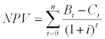
The long-term investment analysis applied the Discounted Cash Flow (DCF) approach for determining the net benefit streams from CA over a long-time as compared to the conventional farming practice. DCF analysis extends a simple cash flow analysis by considering the time value of money and risks of investing in a project. The DCF was used to estimate Net Present Value (NPV).
NPV is expressed as discounted benefit minus discounted cost. Cash outflow comprises of fixed cost and variable costs used in producing a tradable output. The cash inflow comprises of the revenue obtained from crop sales. Mathematical expression of NPV is as follows in Equation 1:
 (1)
(1)
Where: NPV = net present value, B = benefit; C = cost; i = interest rate; and t = time horizon, t=0...n. The most viable activity is identified by looking at the magnitude and positivity of the NPV. When NPV is greater than zero the project is viable and not viable when it is less than zero.
CA agriculture that involves terracing is a long-term activity. Determining long-term streams of net benefits estimates the current payoffs. The assumptions made in the DCF analysis included: (i) Time horizon of 19 years that span into the early century climate projection and planning period of 2030, (ii) A Stern’s discount rate of 1.4% was used as it attaches a higher value on the value of future generation’s welfare contrary to commercial interest rates [25]. The Sterns’ discount rate is given by Ramsey’s equation [26] as follows in Equation 2.
S = ρ +μg
Where: ‘S” is the social discount rate (in Equation 3), “ρ” is the rate of pure time preference, “μ” is the elasticity of the marginal utility of consumption and “g” is the rate of growth of per capita consumption. Stern [27] suggested that ρ is 0.1%, μ is 1% and g is 1.3%, therefore he found that:
S = 0.1+ (1*1.3) =1.4%
Results and Discussion
Poverty status by locality and gender
Results in Figure 4(a) indicate that farmers in the mid to highland area were relatively asset poor compared to those in the lowland. The lowland area is endowed with deeper fertile forested valley bottoms that are used for farming. Female farmers were asset poorer than their counterpart males (Figure 4(b)). Women normally have limited access to productive resources the situation which makes them more impoverished than men.

Figure 4: (a) Distribution of relative wealth across localities (b): Distribution of relative wealth across localities
Farmers have been clearing these new forested valley bottoms seasonally in order to produce more crops. This would have helped the lowland farmers to create more assets from realized agricultural income. Contrary, the mid to highland agro-landscape is characterized with shallow soils on the hillslopes. As part of the REDD+ processes, there has been resistance of farmers to leave the prime land in forested valley bottoms.
Land resource ownership
Ownership to land resource was assessed within two time windows – before and after REDD+ interventions. The intent was to iron out the likely implications of REDD+ process on access to vital land resource. The REDD+ process realigned the ways land was historically accessed. The villages under REDD+ devised land use plans. Under the auspices of the REDD+ project, the VNRC under the guidance of Village Council and General Village Assembly relocated farmers from most of the forested valley bottoms that became under the village protected forests. Relocated farmers were given plots in the village settlement and agricultural land outside the forested valley bottoms. Some refused to leave as they were hardly ready to give up the highly productive forested valley bottoms. To them the opportunity cost of losing such land was so high (Figure 5). In the lowland, the advent of REDD+ reduced an average land on average land by 0.3 of an acre (Table 3). Apparently, the average land holding was relatively bigger than the national average land holding for smallholders of about 2-3 acres. On average the amount of land owned in the mid-highland area remained almost unchanged. At median, a typical household in the lowland owned the same amount of land after as before REDD+ intervention. However, in the mid-highland area a typical household actually accessed more land. As indicated by results at the first quartile, a typically land-constrained household in the lowland gained more land with REDD+ while the same in the mid-highland lost miserably. This is because those relocated from the valley bottoms were given more land outside. Due to restrictions on deforestation for farm expansion even before REDD+, those cultivating in forested valley bottoms tend to manage smaller plots – but with higher yields.

Figure 5: Beans grown in the forested valley bottom in lowland village: Picture by Mutabazi.
The description of the above land use plans is as per the Tanzania village land Act of 1999 where the village council with the endorsement from the Village General Assembly can change land uses within the village boundaries. The Village Land Act categorizes the village land into three-communal land, occupied land and future land. Consequently any decision made by the village council concerning land use changes after the endorsement of the Village General Assembly (the highest decision making body where every member in the village participates) is considered legitimate. That means farmers who have refused to move out from the places assigned to be reserved (recognized as communal land) land are considered illegal land users. In Tanzania none owns land, the land is commonly owned by the citizen under the custodianship of the president [28]. Moreover because of this type of land tenure most households do not consider land as an asset (Table 2).
| Statistics | Lowland | Mid-highland | ||
|---|---|---|---|---|
| Pre-REDD+ | Post-REDD+ | Pre-REDD+ | Post-REDD+ | |
| Mean | 6.2 | 5.9 | 7.4 | 7.4 |
| St. deviation | 4.0 | 2.2 | 6.6 | 6.8 |
| Median | 6.0 | 6.0 | 5.0 | 6.0 |
| Min | 1.0 | 2.5 | 0.0 | 0.0 |
| Max | 18.0 | 10.0 | 25.0 | 25.0 |
| Inter-quartile range | 4.0 | 3.0 | 4.3 | 5.5 |
| 1st quartile | 3.0 | 4.0 | 4.3 | 0.8 |
| 3rd quartile | 7.0 | 7.0 | 8.5 | 8.5 |
Table 2: Land owned (acres) by location.
Before exploring the per capita land holding it is relevant to assess the household size pattern in a pre- and post-REDD periods. On average the household in the mid-highland area was bigger than the household in the lowland with a difference of one person. Post- REDD+ household sizes exceeded that of pre-REDD by one person. The household size grew by an additional of one person over the past three years. However, the asset rich households were larger in size than asset poor ones with no difference between the two periods. The increase in household size in the post REDD+ is an interesting finding. Normally this is attributed to household’s reproduction. In fact with the design of this study and the available data it is difficult to ascertain why there was such an increase. Possibly this could beside reproduction be attributed to the postponement of the grown-ups decisions to move to their own households. The main reason behind this assumption (establishment of new households) is the observed decrease in availability of per capita land owned (Figure 6).

Figure 6: Household size by location and poverty groups.
Apparently, the per capita land owned remained around 1 acre. The per capita land owned decreased among the households in the midhighland area by a difference of 0.2 an acre in post-REDD period. This is likely to be attributed to growing household size that grew by one person. Irrespective of the reference time periods, a typical household owned around one acre. Those land-constrained households owned less than an acre – marginally over an acre (Table 3).
| Statistics | Lowland | Mid-highland | ||
|---|---|---|---|---|
| Pre-REDD+ | Post-REDD+ | Pre-REDD+ | Post-REDD+ | |
| Mean | 1.2 | 1.1 | 1.3 | 1.1 |
| St. deviation | 1.1 | 0.7 | 1.0 | 0.8 |
| Median | 1.0 | 0.9 | 0.9 | 0.9 |
| Min | 0.1 | 0.4 | 0.3 | 0.0 |
| Max | 4.5 | 3.0 | 3.8 | 3.0 |
| Inter-quartile range | 0.8 | 0.7 | 1.4 | 0.6 |
| 1st quartile | 0.6 | 0.7 | 0.7 | 0.6 |
| 3rd quartile | 1.4 | 1.4 | 2.1 | 1.3 |
Table 3: Land owned per capita (acres) by location.
Consistently, the asset rich owned more land than the relatively asset poor (Table 4). However, in both periods the average owned land declined. However, at median, a typical asset-rich household owned more land after REDD+ intervention whereas the asset-poor managed the same amount of land. The social status of relatively wealthier households may grant them a favour from local institutions involved in land allocation. A typically land constrained household (first quartile) in the asset-rich group seems to have benefitted from REDD+ intervention by gaining more land – about one acre. Contrary, the land constrained asset-poor household was further deprived of land following REDD+ interventions.
| Statistics | Asset rich | Asset poor | ||
|---|---|---|---|---|
| Pre-REDD+ | Post-REDD+ | Pre-REDD+ | Post-REDD+ | |
| Mean | 8.1 | 8.0 | 5.7 | 5.4 |
| St. deviation | 6.4 | 5.5 | 4.4 | 4.5 |
| Median | 6.3 | 6.8 | 5.0 | 5.0 |
| Min | 1.0 | 2.5 | 0.0 | 0.0 |
| Max | 25.0 | 25.0 | 20.0 | 20.0 |
| Inter-quartile range | 6.4 | 4.8 | 2.5 | 4.3 |
| 1st quartile | 3.4 | 4.3 | 4.3 | 2.5 |
| 3rd quartile | 9.8 | 9.0 | 6.8 | 6.8 |
*Mean differences were statistically significant at P<0.001
Table 4: Land owned (acres) by poverty.
It is imperative to shed light on the dynamics of farmland markets; which is also critical in land access arrangements. The REDD+ interventions are likely to influence the supply and demand of land that will be reflected in land rents. This consideration prompted analysis of costs hiring and buying land. In the case study villages, both the purchase and rental values of land depend on the quality of the land. The forested land is more fertile and productive hence commands higher purchase price and rent compared to the nonforested land. This has been the motivation behind clearing forest to put this land under crop production. Results in Table 5 indicate that the land rent in the post REDD+ period was significantly (P<0.001) higher than before REDD+ interventions – for both forested and non-forested land. The rent of forested land was also significantly higher in both before and after REDD+ interventions. The rent of forested land was twice and thrice as much as non-forested land in the two reference periods. The costs of purchasing land follow similar patterns as in case of hiring (Table 6). Generally, the rental and exchange values of farmland seem to have increased significantly following advent of REDD+ interventions. The forested farmland commands higher rent and market price making it still prone to deforestation.
| Statistics | Non-forested farmland | Forested farmland | ||
|---|---|---|---|---|
| Pre-REDD+ | Post-REDD+ | Pre-REDD+ | Post-REDD+ | |
| Mean* | 6.8 | 14.3 | 17.8 | 36.9 |
| St. deviation | 3.4 | 6.5 | 17.5 | 36.6 |
| Median | 6.7 | 13.3 | 13.3 | 26.7 |
| Min | 3.3 | 4.0 | 5.0 | 10.0 |
| Max | 13.3 | 30.0 | 66.7 | 146.7 |
| Inter-quartile range | 10.0 | 5.0 | 11.0 | 19.2 |
| 1st quartile | 3.3 | 10.8 | 7.3 | 18.3 |
| 3rd quartile | 9.2 | 15.8 | 18.3 | 37.5 |
Table 5: Cost of hiring land (USD/acre).
| Statistics | Outside forested land | Inside forested land | ||
|---|---|---|---|---|
| Pre-REDD+ | Post-REDD+ | Pre-REDD+ | Post-REDD+ | |
| Mean* | 30 | 72 | 70 | 148 |
| St. deviation | 17 | 46 | 50 | 114 |
| Median | 25 | 67 | 63 | 123 |
| Min | 8 | 18 | 20 | 37 |
| Max | 83 | 200 | 217 | 467 |
| Inter-quartile range | 13 | 50 | 63 | 104 |
| 1st quartile | 20 | 33 | 33 | 71 |
| 3rd quartile | 33 | 72 | 96 | 175 |
* Mean differences were statistically significant at P<0.001
Table 6: Cost of buying land (USD/acre).
Furthermore, with respect to land access, we also assessed the demand for agricultural land at the household level in the near future (Table 7). Such looking into the future makes a rough prediction of the future land requirements. This can as well help to estimate local deforestation rates. On average, a household in the lowland and midhighland wished to acquire 2 and 3 acres of additional farmland in the next 5-10 years, respectively. The relatively poor will require less land compared to their counterpart richer households (Table 8).
| Lowland | Mid-highland | |
|---|---|---|
| Mean | 1.8 | 2.7 |
| St. deviation | 1.7 | 4.4 |
| Median | 2.0 | 1.0 |
| Min | 0.0 | 0.0 |
| Max | 5.0 | 15.0 |
| Inter-quartile range | 3.5 | 3.8 |
| 1st quartile | 0.0 | 0.0 |
| 3rd quartile | 3.5 | 3.3 |
Table 7: Additional land (acres) needed in the next 5-10 years by location.
| better-off | worse-off | |
|---|---|---|
| Mean | 3.25 | 2.00 |
| St. deviation | 4.07 | 2.42 |
| Median | 2.00 | 0.50 |
| Min | 0.00 | 0.00 |
| Max | 15.00 | 6.00 |
| Inter-quartile range | 4.00 | 4.75 |
| 1st quartile | 0.00 | 0.00 |
| 3rd quartile | 4.00 | 4.75 |
Table 8: Additional land (acres) needed in the next 5-10 years by poverty.
The additional land will be obtained through forest encroachment. The agricultural expansion will first start on the village land demarcated for agriculture; then into the conserved village forest and likely in far future into the protected REDD forest. The later forest is strictly protected particularly for the sake of anticipated REDD-related carbon trade benefits.
Forest resource access
Physical proximity to the protected REDD+ forest indicate the likely interaction with the forest resource. Expectedly, those living closer to the REDD+ forest are likely to have traded off more benefits they used to get from the forest. Residents of the lowland area have to walk 5 kilometres or almost 2 hours on average before reaching the REDD+ forest (Table 9). For those residing in the mid-highland area would reach the REDD+ forest in or an hour time. The REDD+ forest is located in the mountainous highland.
| Lowland | Mid-highland | |
|---|---|---|
| Distance in km | ||
| Mean | 4.9 | 2.9 |
| St. deviation | 4.1 | 2.2 |
| Median | 4.0 | 2.0 |
| Min | 17.0 | 0.2 |
| Max | 16.0 | 7.0 |
| Walking time in minutes | ||
| Mean | 150 | 69 |
| St. deviation | 85 | 48 |
| Median | 120 | 60 |
| Min | 60 | 15 |
| Max | 360 | 180 |
Table 9: Distance to the REDD+ forest.
Attempts were made to estimate the quantities of different forest products utilized among the communities. With exception of mushrooms which are collected from the REDD+ forest, the rest of the forest products are procured from the village forest. In terms of biomass quantity, the leading product in the lowland is fuel-wood which is the most prominent source of energy, followed by charcoal (Table 10). In the mid-highland, charcoal is not a common product as no villager was involved in charcoal making (Table 11). There could be outsiders involved in charcoal business. The consumption rate of fuel-wood per household in the mid-highland was lower than in the lowland. This difference could be attributed to relatively higher adoption of improved fuel-wood stoves in the mid-highland. The value of tradable forest products was about US$ 165/household.
| timber (number) | Charcoal (bags) | Fuelwood (bundles) | building poles (numbers) | Mushroom (collections) | Honey (litres) | |
|---|---|---|---|---|---|---|
| Mean | 10 | 120 | 203 | 15 | 28 | 51 |
| Std. Dev. | 8.96 | - | 155.1 | 11.4 | 28.1 | 59.3 |
| Median | 4 | 120 | 243 | 13 | 12 | 13 |
| Min | 4 | 120 | 41 | 3 | 6 | 3 |
| Max | 17 | 120 | 487 | 33 | 80 | 133 |
| Inter quartile | 9 | 0 | 246 | 5 | 10 | 65 |
| 1st quartile | 4 | 120 | 58 | 13 | 8 | 8 |
| 3rd quartile | 13.5 | 120 | 304 | 18 | 18 | 73 |
Table 10: Utilization of forest products per year: lowland village.
| timber (number) | Charcoal (bags) | Fuelwood (bundles) | building poles (numbers) | Mushroom (collections) | Honey (litres) | |
|---|---|---|---|---|---|---|
| Mean | 71 | - | 44 | 8 | 56 | 1 |
| Std. Dev. | 57 | - | 22 | 7 | 56 | - |
| Median | 60 | - | 35 | 7 | 38 | 1 |
| Min | 20 | - | 26 | 1 | 6 | 1 |
| Max | 167 | - | 81 | 20 | 150 | 1 |
| Inter quartile | 70 | - | 7 | 6 | 36 | 0 |
| 1st quatile | 25 | - | 35 | 4 | 24 | 1 |
| 3rd quartile | 95 | - | 42 | 10 | 60 | 1 |
Table 11: Utilization of forest products per year: mid-highland.
The relatively poor collected more fuel-wood from the forest and less honey compared to richer households (Tables 12 and 13). Low adoption of improved stoves aggravated fuel-wood consumption particularly among the poor. Apparently, the poor were not involved in charcoal production. This suggests that charcoal business is done by the relatively rich people in the villages who collaborate with urban based businesses. Charcoal supply chains are sustained by rich businesses in urban destination markets where the big consumers are located.
| Timber (number) | Charcoal (bags) | Fuelwood (bundles) | building poles (numbers) | Mushroom (collections) | Honey (litres) | |
|---|---|---|---|---|---|---|
| Mean | 43 | 120 | 112 | 14 | 49 | 93 |
| Std. Dev. | 38 | - | 115 | 12 | 47 | 57 |
| Median | 30 | 120 | 60 | 10 | 31 | 93 |
| Min | 4 | 120 | 26 | 3 | 12 | 53 |
| Max | 100 | 120 | 365 | 33 | 150 | 133 |
| Inter quartile | 53 | 0 | 50 | 14 | 42 | 40 |
| 1st quartile | 18 | 120 | 42 | 5 | 18 | 73 |
| 3rd quartile | 70 | 120 | 91 | 18 | 60 | 113 |
Table 12: Utilization of forest products per year: better-off.
| timber (number) | Charcoal (bags) | Fuelwood (bundles) | building poles (numbers) | Mushroom (collections) | Honey (litres) | |
|---|---|---|---|---|---|---|
| Mean | 93 | - | 209 | 10 | 20 | 6 |
| Std. Dev. | 104 | - | 187 | 6 | 27 | 7 |
| Median | 93 | - | 243 | 12 | 7 | 3 |
| Min | 20 | - | 35 | 1 | 6 | 1 |
| Max | 167 | - | 487 | 13 | 60 | 13 |
| Inter quartile | 73 | - | 226 | 4 | 27 | 0 |
| 1st quartile | 57 | - | 35 | 8 | 6 | 2 |
| 3rd quartile | 130 | - | 261 | 12 | 33 | 2 |
Table 13: Utilization of forest products per year: worse-off.
The REDD+ project promotes the use of improved fuelwood stove. However, the adoption is still low particularly in the lowland area (Table 14). The adoption is also relatively low among the poor households. Diffusion of improved fuel wood stoves would cut down the demand for wood as source of cooking energy – hence reduce the deforestation rates. There is a need to study conditions necessary for accelerated adoption and diffusion of improved stove technology.
| Improve stove | Traditional three stones | |||
|---|---|---|---|---|
| Location | n | % | n | % |
| Lowland | 6 | 31.6 | 9 | 69.2 |
| Mid-Highland | 13 | 68.4 | 4 | 30.8 |
| Poverty | ||||
| Better-off | 11 | 57.9 | 5 | 38.5 |
| Worse-off | 8 | 42.1 | 8 | 61.5 |
Table 14: Adoption of improved cooking stoves.
Food security situation
Food availability is an important pillar of food security in the rural setting. However, households can access food from the market where the food markets are functional and people have incomes to spend on food. In the localities, average per capital maize availability was higher before than after REDD+ interventions (Table 15). Maize is an important staple in Tanzania – accounting for 33% of the calories in the total diet. The amount of maize refers to the total harvest entailing both consumed and marketed produce. Consistently, households in the mid-highland had higher maize availability per capita. The food production has declined significantly in the lowland following REDD+ interventions especially in the lowland and among the relatively poorer households (Tables 16). In the post-REDD+ period, the average maize production per capita declined by 40% in the lowland area and by 22% among the poor. With 1 kg of maize supplying around 3620 calories and an average person requires 2500 calories per day or 912,500 calories per year. At least 250 kilograms of maize are required to supply the required calories per person. Despite of its centrality in food security, the production of maize is generally low.
| Statistics | Lowland | Mid-highland | ||
|---|---|---|---|---|
| Pre-REDD+ | Post-REDD+ | Pre-REDD+ | Post-REDD+ | |
| Mean | 154 | 91 | 193 | 206 |
| St. deviation | 109 | 44 | 126 | 135 |
| Median | 135 | 92 | 143 | 130 |
| Min | 30 | 18 | 34 | 48 |
| Max | 400 | 166 | 473 | 400 |
| Inter-quartile range | 150 | 64 | 160 | 235 |
| 1st quartile | 60 | 60 | 98 | 101 |
| 3rd quartile | 210 | 124 | 257 | 336 |
Table 15: Maize production per capita (kgs) by location.
| Statistics | Better-off | Worse-off | ||
|---|---|---|---|---|
| Pre-REDD+ | Post-REDD+ | Pre-REDD+ | Post-REDD+ | |
| Mean | 169 | 156 | 179 | 140 |
| St. deviation | 119 | 120 | 120 | 106 |
| Median | 136 | 111 | 140 | 125 |
| Min | 34 | 34 | 30 | 18 |
| Max | 473 | 400 | 390 | 400 |
| Inter-quartile range | 110 | 195 | 191 | 112 |
| 1st quartile | 92 | 63 | 86 | 59 |
| 3rd quartile | 202 | 258 | 276 | 171 |
Table 16: Maize production per capita (kgs) by poverty.
Economic viability of REDD+ mitigations
The earlier descriptives have suggested negative implications of REDD+ interventions regarding limiting access to productive forested and related short-term food availability. These externalities were implicit in the REDD+ design as it is known that farmers had immediate gains from clearing virgin forestlands that produce more food with limited used of inputs. However, this conversional practice jeopardises the longterm sustainable productivity of the agro-landscape. This prompted the REDD+ project to promote intensive agricultural practices that enhance productivity per unit land and ultimately avail more food in a manner that mitigates deforestation and degradation. Among such agricultural practices include CA – that here forth we assess their economic viability in terms of associated long-term costs and benefits. CA practices coupled with intensification and best agronomic practices are compared with deforesting and degrading conventional practices – entailing flat cultivation, tillage along the sloping hills and non-use of best agronomic practices.
The analysis of cost structure indicates that CA involving minimum tillage and fanya terracing is costly – i.e. capital and technological intensive (Figure 7). The large share of total cost is associated with variable inputs such as inputs and labour than the fixed costs incurred to acquire the tools. Tenge et al. [29] estimated the costs and benefits of different CA technologies – grass strips, fanya juu and bench terraces in Lushoto, Northern Tanzania. They found that bench terraces required higher capital investment of USD 215/ha compared to USD 165/ha and USD 84/ha for fanya juu and grass strips technologies, respectively. The long-term payoffs associated with bench terraces were impressive – with Internal Rate of Return of 19% compared to 14% and 6% for fanya juu and grass strips. This implies that despite of higher returns, robust CA measures may be less adopted among resource poor farmers facing liquidity constraint– particularly where microfinance non-existent.

Figure 7: Costs structure of conventional and CA practices.
The long-term stream of net benefits associated with CA (which includes minimum tillage and fanya juu terracing used as proxies for costs estimation) was assessed using NPV. Adoption of CA technologies over conventional farming (non-CA referred to as BaU in the conceptual model) was economically viable with impressive longterm payoffs (Figure 8). Stern’s welfarist discounting rate estimated much higher benefits with adoption of CA. Stern’s discounting rate attaches higher time value of money for the adaptation and mitigation actions done today and not postponed for tomorrow. This means, it is highly viable to embark on CA in the case study villages under REDD+. The long-term benefits estimated with the commercial discounting rate were still positive – hence viable. The commercial interest rate heavily devalues the future stream of net benefits by counting on investment risks and uncertainties.

Figure 8: Long term economic viability of conventional and CA practices.
The use of two discounting rates is relevant in the REDD+ context. The Stern’s approach is in favour of fund based approach to REDD+– where the international community has to grant out adaptation and mitigation resources. The commercial interest rate reflects the market based funding where adaptation and mitigation finances are allocated competitively.
Conclusions and Policy Implications
The household and farm-level livelihood implications of REDD+ interventions are a mixture of negative short-term impacts and longterm payoffs. Some poor farming households are losing out access to forested fertile land they used to cultivate with limited inputs to accrue impressive rents. Before the invention of REDD+ there were no stringent rules to the forested land in most of the villages involved in the project. The communities were enjoying the benefit of expansion of their farms to the forest landscapes within their village boundaries. The expansions were meant to tap the favourable climatic condition for increase of their agriculture productivity when their farms lost agricultural values. The REDD+ advents came with land use plans which was not a common practice before. As a result the suitable lands for forests are now set aside for forest reserve purposes hence forth carbon sequestration. The establishment of the reserved forests is backed with formulation of bylaws which are enforced by the village authorities. Consequently the households that lack good adoption strategies to this new style of village land management are highly negatively impacted. These according to the findings happen to be the poorest of the poor. Unless REDD+ comes up with a better strategy to mitigate this impact to the particular group of households, the initiatives might be contrary to REDD+ intentions and that is where the compensation concept comes in. If these households would be compensated through various ways or mechanisms, (which are out of scope of this research paper) the problems of illegal harvest of timber resources (a common practice to most of reserved forests in the country) might be resolved. Short of this the sustainability of REDD+ can face a lot of resistance including illegal deals from these typical households. Moreover, thorough research on this is recommended to come up with ways which could bring into practice the concept of win-win scenarios.
Besides, increasing productivity per unit land through intensification would be critical in mitigating deforestation and degradation. Following this, the compensation can be through subsidizing CA with the cash received from urban population (secondary users) and better off households within the village which are revealed in this study. This is because the long-term payoffs from intensification are tangible. Promotion of agricultural intensification, such as integrated conservation agriculture, would need functioning pro-poor credit, and input and output markets. The linkages to profitable markets must address market risks by availing market infrastructure and price transparency.
Other mitigation pathways will be to promote off-farm income activities. This will reduce charcoal trade which is the second driver of deforestation and degradation. Accelerated diffusion of energy saving technologies, such as the improved fuel-wood stoves, is critical. The limiting factors and conditions necessary for increased adoption have to be investigated and resolved. All these require cash which can be accrued from the secondary users. This study has not researched on issues of ecosystem service payments and willingness to pay of the potential users of the ecosystem services mostly the urban population. We therefore recommend such studies to be conducted to supplement REDD+ initiatives. The expected revenue from these potential ecosystem services consumers when combined with those anticipated to be received from developed countries (an obligation of the developed countries considered as Annex 1 in REDD+ concept) under REDD+ to compensate the development of the developing countries would bring a significant impact to the lives of the poor.
Acknowledgements
This document has been produced with the financial assistance of the Norwegian Government through NORAD, as part of a multi-country project coordinated by IIED in partnership with UMB on Poverty and Sustainable Development Impacts of REDD Architecture. The views expressed in this document are the sole responsibility of the authors and do not necessarily represent the views of the institutions involved in this project or of NORAD. Extended to NORAD funded Climate Change Impact Adaptation and Mitigation Programme (CCIAM) for supporting the production of the paper.
1 The “Land Sparing Hypothesis” states that intensification, and subsequent increases in agricultural yields, reduces the amount of agricultural land necessary for farmers to earn a living or make a certain level of profit, reducing the need to clear forests for additional agricultural land ( [17,28])
References
- Tubiello FN, Salvatore M, Simone Rossi S, Ferrara A, Fitton N, et al. (2012) The FAOSTAT database of greenhouse gas emissions from agriculture. Environ Res Lett.
- Morgan-Brown T (2012) Applying the Verified Carbon Standard (VCS) in a REDD pilot project in Tanzania: a description of the MJUMITA and TFCG approach. The Arc Journal: Special Edition on REDD. MJUMITA.
- Zahabu E (2008) Sinks and sources: A strategy to involve forest communities in Tanzania In global climate policy. Dissertation to obtain the degree of doctor at the University of Twente, the Netherlands.
- Murray B, Olander L (2008) A Core Participation Requirement for Creation of a REDD marke. Nicholas institute for environmental policy solutions.
- Vatn A, Vedeld P, Petursson JG, Stenslie E (2009) The REDD direction. The potential for reduced carbon emissions, biodiversity protection and increased development. A desk study with special focus on the situation in Uganda and Tanzania. Noragric Report.
- Mombo F, Speelman S, Van Huylenbroeck G, Hella J, Munishi P, et al. (2011) Ratification of the Ramsar convention and sustainable wetlands management: Situation analysis of the Kilombero Valley wetlands in Tanzania. Journal of Agricultural Extension and Rural Development 3: 102-112.
- Mwijage A, Andersson J, de Ridder N, Baijukya F, Cesare Pacini C, et al. (2011) Impact of land tenure change on subsistence agriculture: Implication on farm productivity of the farming system in Bukoba district, Tanzania. Journal of African Studies and Development 3: 33-44.
- Komu F (2012) Land management at crossroads in Africa: impact of the Tanzania Village Land Act No. 5 of 1999 on the fate of customary land tenure. FIG Working Week 2012. Rome, Italy.
- Angelsen A, Brockhaus M, Sunderlin W, Verchot L (2012) Analysing REDD+ Challenges and Choices. Bogor, Indonesia: Center for International Forestry Research (CIFOR).
- Graham K, Vignola R (2011) REDD+ and agriculture: A cross-sectoral approach to REDD+ and implications for the poor. REDD-net Programme.
- TFCG and MJUMITA (2012) Improving agricultural practices in the context of REDD readiness in Lindi Rural District, Tanzania: a review of current agricultural practices and recommendations for project interventions.
- FAO (2010) Global Forest Resource assessment. Key Findings and Databases. FAO Forestry Paper. Rome, Italy: Food and Agriculture Organization (FAO).
- Rademaekers K, Eichler L, Berg J, Obersteiner M, Havlik P (2010) Study on the Evolution of Some Deforestation Drivers and Their Potential Impacts on the Costs of an avoiding Deforestation Scheme. Brussels, European Commission Directorate-general for Environment, Belgium.
- Pirard R, Belna K (2012) Agriculture and deforestation: Is REDD+ rooted in evidence? For Policy Econ 21: 62-70.
- Shively GE, Pagiola S (2004) Agricultural intensification, local labor markets, and deforestation in the Philippines. Environ Dev Econ 9: 241-266.
- Lambin EF, Meyfroidt P (2011) Global land use change, economic globalization, and the looming land scarcity. Proc Natl Acad Sci U S A 108: 3465-3472.
- DeFries R, Rosenzweig C (2010) Toward a whole-landscape approach for sustainable land use in the tropics. Proc Natl Acad Sci U S A 107: 19627-19632.
- Pirard R, Treyer S (2010) Agriculture and deforestation: What role should REDD+ and public support policies play? Idé es pour le dé bat N°10/2010. Paris, France: IDDRI (Institut du Dé velopment durable et des relations internationals).
- Luoga EJ (2000) Subsistence use of wood products and shifting cultivation within miombo woodland of eastern Tanzania, with special notes on commercial uses. South African Journal of Botany 66: 72-85.
- Grogan K, Birch-Thomsen T, Lyimo J (2013) Transition of Shifting Cultivation and its Impact on People’s Livelihoods in the Miombo Woodlands of Northern Zambia and South-Western Tanzania. Human Ecology 41: 77-92.
- KDC (2000) The three-year development plan 2000 - 2003 for Kilosa District. Kilosa District Council.
- Derman B, Odgaard R, Sjaastad E (2007) Contested Identities & resource Conflicts in Morogoro Region, Tanzania - Who is Indigenous? Conflicts over land & water in Africa. Oxford, James Currey.
- Shishira EK, Yanda PZ (1997) Kilosa District: Land Use and Natural Resource Assessment. Report Prepared for Kilosa District Council/Irish Aid. Dares Salaam, Institute of Resource Assessment.
- Filmer D, Pritchett LH (2001) Estimating wealth effects without expenditure data--or tears: an application to educational enrollments in states of India. Demography 38: 115-132.
- Dietz S (2008) A long-run target for climate policy: the Stern Review and its critics.
- Ramsey FP (1928) ‘A Mathematical Theory of Saving’. Economics Journal 38: 543-559.
- Stern N (2006) The Economics of Climate Change: The Stern Review. Cambridge University Press, Cambridge, UK.
- United Republic of Tanzania (URT) (1999) The Land Act. Dar es Salaam. Tanzania.
- Tenge AJ, De Graff J, Hella JP (2005) Financial efficiency of major soil and water conservation measures in West Usambara highlands, Tanzania. Applied Geography 25: 348-366.
Relevant Topics
- Aquatic Ecosystems
- Biodiversity
- Conservation Biology
- Coral Reef Ecology
- Distribution Aggregation
- Ecology and Migration of Animal
- Ecosystem Service
- Ecosystem-Level Measuring
- Endangered Species
- Environmental Tourism
- Forest Biome
- Lake Circulation
- Leaf Morphology
- Marine Conservation
- Marine Ecosystems
- Phytoplankton Abundance
- Population Dyanamics
- Semiarid Ecosystem Soil Properties
- Spatial Distribution
- Species Composition
- Species Rarity
- Sustainability Dynamics
- Sustainable Forest Management
- Tropical Aquaculture
- Tropical Ecosystems
Recommended Journals
Article Tools
Article Usage
- Total views: 16472
- [From(publication date):
December-2014 - Sep 03, 2025] - Breakdown by view type
- HTML page views : 11779
- PDF downloads : 4693