Study of Erosion and Sediment in the Zarak Catchment Area at Yazd Province, Iran, Using Modified P.S.I.A.C, E.P.M and B.L.M Methods and Comparison of them
Received: 31-Mar-2017 / Accepted Date: 20-Sep-2017 / Published Date: 26-Sep-2017 DOI: 10.4172/2157-7617.1000413
Abstract
Yazd province is one of the arid provinces of Iran and such regions are expected to experience wind erosion. Unlike expectation, in the Zarak catchment area that is located at Yazd province, because of fixation of the soil surface, water erosion is more than wind erosion. On the other hand, due to daily temperature changes, geological formations split and then due to heavy showers, such split blocks provide ideal conditions for surface erosion. Of course, on slopes, rill erosion can be seen. Also in the waterways, when flow discharge increase, due to concentration of the kinetic energy of water in the bends of waterway, bank erosion is found.
Given the importance of soil protection programs and determining the methods of management of erosion and sediment as well as the reduction of calculation and the detailed design of the dam size at the storage dams, it is necessary to estimate total size of annual erosion and sediment in a catchment area. The Zarak catchment area is no exception. On the other hand with respect to the existence of multiple methods to do this, using a method with more reasonable data and saving cost and time, in addition providing acceptable and realistic answer is needed. Of course many parameters are involved. According to these matters, in this study, to study erosion and sediment, quantitative methods of modified Pacific Southwest Inter-Agency Committee (P.S.I.A.C) and Erosion Potential Method (E.P.M), also qualitative Bureau of Land Management (B.L.M) method were used and in the end, the results were compared. With using topographic maps and aerial photos, the initial map of each type of erosion was prepared and then by combining them with data and maps of rocks sensitivity, erosion, geology, geomorphology, slopes, vegetation types and land capabilities, etc. a base map was prepared. After that, by conducting field inspection, base map’s information was controlled and status of various erosions, slope, vegetation, condition of the bed and banks of the waterways, width and depth and materials of the bed and waterways were determined. Also erosion forms classes and their ranges were identified and the most important factors involved in the intensification of erosion were identified with using modified P.S.I.A.C, E.P.M and B.L.M methods.In the end ,the results of the three methods were compared.
Abbreviations
P.S.I.A.C: Modified Pacific Southwest Inter-Agency Committee; E.P.M: Erosion Potential Method; B.L.M: Bureau of Land Management
Introduction
Surface soil is uppermost part of the solid crust of the Earth's surface that form a loose and thin cover, covered by rocks that still has not been destroyed [1]. Due to fertility and being source of income and production, it is location of life of all living creatures on the surface of the Earth and it is the most important natural resources of each country. Soil erosion occurs when the soil is destroyed by erosive factors [2]. The word in geology was used by Ponce to explain the process of formation of valleys in 1894 [3].
In areas where erosion is not controlled, the soil gradually loses its fertility and this causes a great loss. With deposition in streams, reservoir of dams and ports, reducing their intake capacity and flood, causes great damage [4]. According to studies conducted, between 5 and 7 percent of total of the lands of the world is losing fertility every year. The amount of erosion in Iran in the past 20 years has been around one billion tons per year [5]. Given the importance of these explanations, importance of erosion and management of erosion become clear.
In many parts of Iran, rainfall is low and its distribution is not regular and because of this, lack of vegetation is found in most parts. Presence of sensitive geological formations such as marl Miocene sediments in the central and southern and the western parts of the Country, cause increasing erosion and decreasing vegetation in these areas [6].
Yazd province, given its specific geographic location and physiographic position and shortage of water resources, has severe desert condition. Due to limited rainfall, water erosion in this area has been reduced and main erosion is wind erosion [7]. But due to loss of vegetation and soil erosion inhibiting factors and severe rains, the surface of the soil is heavily exposed to rain hits. Because of it, after every rain, muddy water flows are seen on the surface grooves which connecting of them, causes flooding and sometimes flowing mud. The resulting run off, leaving silt and clay particles. Due to the effect of the high percentage of silt, finally creates dry smooth coverage which easily transported by wind and due to high percentage of clay, results in formation a dry and non-permeable crust on the surfaces [8].
Catchment basin of the Zarak located on 140 kilometers North East of Yazd city in longitude 54° 32' and 30" to 54° 37' and 32" and latitude 32 ° 25' to 32° 30'. Its elevation above sea level is at least 2120 meters and at most 2820 meters and its average height is 2330 meters and an area of the catchment is equal to 3317 hectares and its average slope is 25% and length of main waterway in it is 10.1 kilometers.
The average yearly rainfall is 297 millimeters and most of its distribution is in late fall and early winter. The average annual temperature is 9.2°C and the hottest month has temperature of 16.2°C and the coldest month has average temperature of 2.5°C and the climate in this area based on Emberger method is cold and arid. Figure 1 shows Location of the Zarak catchment area in Iran.
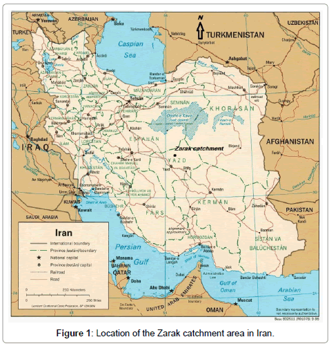
Figure 1: Location of the Zarak catchment area in Iran.
Research Methodology
In this research, it was needed to use various informations and many data for simultaneously computing of erosion and sediment by modified P.S.I.A.C, E.P.M and B.L.M methods [9]. According to it, the following procedure was adopted:
1. Collecting and processing information and use topographic maps to identify areas at 1: 50,000 scale and aerial photographs at a scale of 1:55,000.
2. Interpretation of aerial photographs and preparing their mosaic.
3. Equalize scales of mosaic of aerial photographs and topographical maps and obtaining the initial map of erosion types with using them.
4. Preparing data and maps of rocks sensitivity to erosion, geology, geomorphology, slope, land capability, vegetation types, etc.
5. The combination of the initial map of erosion types with data and maps mentioned in the fourth paragraph to the separate homogeneous units so that these units have characteristics as much as possible and have the same natural features, thus the base map was prepared.
6. Conducting field observations in order to control the base map data and determine the status of types of erosion, slope of areas, the vegetation ,condition of the bed and banks of the waterways, width and depth and material of the bed and banks of the waterways and etc.
7. Review and analysis of field observations and identifying the classes of erosion forms and characteristics of each of them.
8. Examining the characteristics of each unit and identifying and analyzing the factors that aggravating erosion.
9. Examine the factors in quantitative methods of modified P.S.I.A.C, E.P.M and qualitative method of B.L.M.
10. Comparing the results of the three methods listed.
Results
For the aforementioned area, six erosion types were observed, which were denoted by conventional signs, S represents the surface erosion, R represents the rill erosion and B represents the bank erosion. Also rate of erosion was considered in the three classes, class 1 represents low erosion, class 2 represents moderate erosion and class 3 represents high erosion. Now, with regard to these, 6 erosion types are as follows:
S1: low surface erosion.
S2R1: complex of moderate surface erosion and low rill erosion.
S2R2: complex of moderate surface erosion and moderate rill erosion.
S3R1: complex of high surface erosion and low rill erosion.
B1S2: complex of low bank erosion and moderate surface erosion.
B2S1: complex of moderate bank erosion and low surface erosion.
Using the method of modified P.S.I.A.C, it became clear that 72.9 percent of the field rated medium erosion also 37.1% of it had low erosion. The maximum amount of specific erosion related to type S2R1 and the lowest one related to B1S2. On the other hand, the highest specific sediment related to erosion type of B2S1 while lowest was related to the S1. Tables 1-5 shows the data used in this method.
| Erosion type / Affecting factors | S1 | S2R1 | S2R2 | S3R1 | B1S2 | B2S1 |
|---|---|---|---|---|---|---|
| Surface geology | 3/5 | 4/5 | 4/8 | 5 | 1 | 1 |
| Soil | 0 | 6/3 | 6/3 | 6/3 | 5 | 5 |
| Weather | 7/6 | 7/6 | 7/6 | 7/6 | 7/6 | 7/6 |
| Sewage | 12 | 11/48 | 12/3 | 9/87 | 10/5 | 13/1 |
| Topography | 8/25 | 7/43 | 6/27 | 4/5 | 1/65 | 1/65 |
| Ground cover | 0/6 | 3 | 3/4 | 4 | 2/8 | 2/4 |
| Land use | 1 | 5 | 3 | 6 | 4 | 5 |
| Erosion across catchment area | 3 | 6/5 | 7/8 | 8/3 | 12/5 | 15/25 |
| Stream erosion | 0 | 0 | 1/67 | 0 | 1/67 | 5 |
| Total scores (R) | 35/96 | 51/8 | 53/1 | 51/57 | 46/72 | 56 |
Table 1: Assessment of factors which involved in sediment production of erosion types in the Zarak catchment area using modified P.S.I.A.C method.
| Erosion type | S1 | S2R1 | S2R2 | S3R1 | B1S2 | B2S1 |
|---|---|---|---|---|---|---|
| Area (mile2) |
4/5 | 4/9 | 1/9 | 1/2 | 0/22 | 0/13 |
| S.D.R | 0/47 | 0/45 | 0/5 | 0/55 | 0/7 | 0/75 |
Table 2: S.D.R value and area of erosion types in the Zarak catchment area.
| Type of erosion Affecting factors |
S1 | S2R1 | S2R2 | S3R1 | B1S2 | B2S1 |
|---|---|---|---|---|---|---|
| Soil erosion class | II | III | III | III | II | III |
| Soil erosion rate | Low | Moderate | Moderate | Moderate | Low | Moderate |
| Type area (km2) | 11/68 | 12/621 | 4/934 | 3/016 | 0/576 | 0/348 |
| Ratio of type area to total catchment area | 5/3 | 38 | 14/9 | 9 | 1/8 | 1 |
| Specific sediment km2.y) /ton ) |
138 | 241/3 | 252/7 | 239/4 | 201/7 | 279/9 |
| S.D.R | 0/47 | 0/45 | 0/5 | 0/55 | 0/7 | 0/75 |
| Specific erosion km2.y) /ton ) |
293/6 | 536/2 | 505/4 | 435/3 | 288/1 | 373/2 |
Table 3: Information related to status and level of specific erosion and specific sediment of erosion types in the Zarak catchment area with using modified P.S.I.A.C method.
| Specific erosion (km2.y /ton ) |
Total erosion (y /ton ) |
Specific sediment (km2.y /ton ) |
Total sediment (y /ton ) |
Area (km2 ) |
|---|---|---|---|---|
| 431 | 14298/9 | 206/2 | 6839/7 | 33/175 |
Table 4: Status of erosion and sediment of the Zarak catchment area with using modified P.S.I.A.C method.
| Sub-catchment Data |
1 | 2 | 3 | 4 | 5 | 6 |
|---|---|---|---|---|---|---|
| Area of sub-catchment (km2) | 9/075 | 6/925 | 3/913 | 4/683 | 6/29 | 2/228 |
| Specific sediment (km2.y / ton) | 221/56 | 192/38 | 193/77 | 210/7 | 212/67 | 195/43 |
| S.D.R. | 0/51 | 0/47 | 0/47 | 0/47 | 0/46 | 0/47 |
| Specific erosion (km2.y / ton) | 434/43 | 409/31 | 412/37 | 448/29 | 462/32 | 415/8 |
Table 5: Information related to status and level of specific erosion and specific sediment of sub-catchments of the Zarak catchment area with using the information obtained for the erosion types of the catchment area with using modified P.S.I.A.C method.
Using E.P.M, it became clear that 98.2 percent of total area had average erosion while 1.8% of it had low erosion. The highest specific erosion rates related to erosion type S2R2 and the lowest related to erosion type of B1S2. The highest rate of specific sediment related to erosion type S2R2 and the lowest related to type B1S2. Tables 6- 10 present data of this method.
| Code of catchment area | 1 | 2 | 3 | 4 | 5 | 6 |
|---|---|---|---|---|---|---|
| (km)D | 0/55 | 0/065 | 0/085 | 0/16 | 0/12 | 0/02 |
| (km)P | 15 | 13 | 9 | 11 | 11-Sep | 06-May |
| (km)L | Mar-92 | 03-Sep | Mar-55 | 03-May | 04-Mar | Jan-53 |
| RU | 0/26 | 0/26 | 0/26 | 0/39 | 0/34 | 0/13 |
Table 6: The RU value and the necessary parameters for the calculation of it in sub-catchments of the Zarak catchment area.
| Erosion type | S1 | S2R1 | S2R2 | S3R1 | B1S2 | B2S1 |
|---|---|---|---|---|---|---|
| RU | 0/35 | 0/35 | 0/38 | 0/33 | 0/3 | 0/33 |
Table 7: RU value for the erosion types in the Zarak catchment area.
| Erosion type | (ψ) | (Xa) | (y) | (I) | (Z) | Soil erosion intensity | Soil erosion class | Specific sediment (km2.y /ton ) |
RU | Specific erosion (km2.y /ton ) |
|---|---|---|---|---|---|---|---|---|---|---|
| S1 | 0/5 | 0/5 | 1 | 25 | 0/5 | Average | III | 110/8 | 0/35 | 316/6 |
| S2R1 | 0/65 | 0/5 | 1 | 22/5 | 0/56 | Average | III | 170/8 | 0/35 | 488/2 |
| S2R2 | 0/7 | 0/5 | 1 | 19 | 0/57 | Average | III | 190/5 | 0/38 | 501/3 |
| S3R1 | 0/7 | 0/5 | 1 | 13/6 | 0/53 | Average | III | 148/3 | 0/33 | 499/4 |
| B1S2 | 0/55 | 0/5 | 1 | 5 | 0/39 | Low | IV | 85/1 | 0/3 | 283/7 |
| B2S1 | 0/6 | 0/5 | 1 | 5 | 0/41 | Average | III | 100/9 | 0/33 | 305/8 |
Table 8: Determination of the erosion and sediment rate of erosion types of the Zarak catchment area with using E.P.M method.
| Area | Total sediment | Specific sediment | Total erosion | Specific erosion |
|---|---|---|---|---|
| (km2) | (ton/y) | (ton/km2.y) | (ton/y) | (ton/km2.y) |
| 33/175 | 4921/1 | 148/3 | 13958 | 420/7 |
Table 9: Status of erosion and sediment of the Zarak catchment area with using E.P.M method.
| Sub-catchment Data |
1 | 2 | 3 | 4 | 5 | 6 |
|---|---|---|---|---|---|---|
| Sub-catchment area (km2) | 9/075 | 6/925 | 3/913 | 4/683 | 6/29 | 2/281 |
| Specific erosion (km2.y / ton) | 442/33 | 393/74 | 401/21 | 424/41 | 443/21 | 412/25 |
| Ru | 0/26 | 0/26 | 0/26 | 0/39 | 0/34 | 0/13 |
| Specific sediment (km2.y / ton) | 115 | 102/37 | 104/3 | 165/5 | 150/7 | 53/6 |
Table 10: Information related to status and level of specific erosion and specific sediment of the Zarak catchment area with using the information obtained for the erosion types of the catchment area with using E.P.M method.
Using the B.L.M method, it was known that 53.3% of the surface of catchment area had minor erosion, while 61.9% of the surface had low erosion and 1.8% had the average erosion and 1 percent of the surface had high erosion. The lowest rates of erosion was of S1 erosion type and its highest was of B2S1 erosion type. Tables 11 and 12 illustrate the data and information of this method.
| Type of erosion Affecting factors |
S1 | S2R1 | S2R2 | S3R1 | B1S2 | B2S1 |
|---|---|---|---|---|---|---|
| 1. The mass movement of soil | 1 | 3 | 4 | 4 | 7 | 9 |
| 2- Litter covering | 2 | 5 | 4 | 6 | 11 | 11 |
| 3- Rocky cover of ground | 4 | 6 | 7 | 8 | 11 | 12 |
| 4. Consolidated rock fragments | 2 | 3 | 4 | 4 | 6 | 9 |
| 5. Surface rills | 2 | 5 | 6 | 6 | 5 | 7 |
| 6. Form of waterways | 1 | 4 | 5 | 5 | 9 | 10 |
| 7-Development of gully erosion | 0 | 0 | 1 | 0 | 1 | 3 |
| Total scores (S.S.F) | 12 | 26 | 31 | 33 | 50 | 61 |
| Point of erosion status factor in the catchment area | 3 | 6/5 | 7/8 | 8/3 | 12/5 | 15/25 |
Table 11: Determining soil surface factor (S.S.F) and erosion status factor in the catchment area for the erosion types in the Zarak catchment area with using qualitative B.L.M method.
| Type of erosion | S1 | S2R1 | S2R2 | S3R1 | B1S2 | B2S1 |
|---|---|---|---|---|---|---|
| Soil erosion rate | Minor | Low | Low | Low | Moderate | High |
| Soil erosion class | I | II | II | II | III | IV |
Table 12: Class and erosion status of erosion types in the Zarak catchment area with using B.L.M qualitative method.
Discussion and Conclusion
There are three forms of erosion in the catchment area including the surface, rill, and bank erosion.Surface erosion has highest area of 35.3 percent of catchment area and is complex with rill erosion or bank erosion at 64.7 percent of the rest of the area. After that, the rill erosion has the high amount of distribution on the surface of the catchment area at 61.9% in complex form with surface erosion. Bank erosion has the lowest distribution in the area with 2.8 percent of the surface of catchment area, in complex form with surface erosion and generally acts locally. The factors influencing the erosion include natural factors and human factors and of the natural factors, climatic factors have the greatest effect, which refers to the violent nature of the area. After that, soil factors, surface covering factors, hydrological factors, physiographical and topographical factors, and finally geological factors are important respectively.
From the point of view of human factors, factors related to excessive grazing of livestock have highest priority and after that, factors related to the local people and plant using for fuel are considerable. Natural factors generally have more effect than human factors. From the point of view of the using methods for assessment of erosion and sediment, it should be noted that if in a catchment area, data related to water discharge and sediment discharge are enough, conventional statistical methods can be used [9]. But shortage of data about soil erosion and sediment producing, due to lack of sediment measurement stations, etc. in the Zarak catchment area caused us to use experimental methods, though models developed abroad cannot be used with confidence in tests inside Iran. Given the conditions of the Zarak catchment area, like other catchment areas, the modified P.S.I.A.C method or EPM were used because modified P.S.I.A.C method is prior method for arid and semiarid areas, and gives acceptable results in such areas. E.P.M method is acceptable for regions which are without meteorological statistics, and in short time provides quantitatively data for us. But since it is used for former Yugoslavia, and its weather is different from arid and semi-arid weather of Iran, it is not proposed for the Zarak catchment area [9]. On the other hand, modified P.S.I.A.C method uses 9 factors while E.P.M method incorporates only 3 factors. Also in E.P.M method, factor of slope has an effective role in erosion while mountainous areas of the Zarak catchment area have high slope and rock mass with low erosion. For this reason in modified P.S.I.A.C method, erosion level in regions with rock mass in the area (S1 erosion type), is obtained low and it is more consistent with reality, while it is obtained average in E.P.M method. Use of B.L.M qualitative method is useful in certain conditions and only for preliminary and qualitative evaluation, because figures and values of erosion and sediment are not provided to us by it, and it is not recommended in the most conditions. In the end, in catchment area studied, modified P.S.I.A.C method is acceptable and realistic and according to climate of this region, same other catchment areas of Iran, it provides more accurate results, which can be used to management of erosion and sediment, soil preservation, calculation and design of dam volume in construction of reservoir dams, etc.
References
- Famouri J, Divan M (1960) Soils of Iran. The Department of Agriculture Press, p. 383.
- Nakhjavani F (1972) The fight against erosion and modification of the catchment area. University of Tehran Press, p. 386.
- Alizadeh A (1989) Erosion and soil conservation. trans. Razavi AQ, p. 258.
- Ahmadi H (1995) Applied geomorphology, Vol. 1 (water erosion). University of Tehran Press, p. 614.
- Mahdavi M (1995) Applied hydrology, Vol. 1. University of Tehran Press, p. 362.
- Ekhtesasi M (1996) Finding origin of sand hills in Yazd plain. The Research Institute of Forests and Rangelands.
- Qobadian A (1982) Natural landscape in Yazd province. Ahvaz University Press, p. 350.
- Qadiri H (1993) Soil conservation. Martyr Chamran University Press, p. 470.
- Refahi H (1996) Water erosion and its control. University of Tehran Press, p. 551.
Citation: Owfi RE (2017) Study of Erosion and Sediment in the Zarak Catchment Area at Yazd Province, Iran, Using Modified P.S.I.A.C, E.P.M and B.L.M Methods and Comparison of them. J Earth Sci Clim Change 8: 413. DOI: 10.4172/2157-7617.1000413
Copyright: © 2017 Owfi RE. This is an open-access article distributed under the terms of the Creative Commons Attribution License, which permits unrestricted use, distribution, and reproduction in any medium, provided the original author and source are credited.
Select your language of interest to view the total content in your interested language
Share This Article
Recommended Journals
Open Access Journals
Article Tools
Article Usage
- Total views: 3893
- [From(publication date): 0-2017 - Nov 26, 2025]
- Breakdown by view type
- HTML page views: 3017
- PDF downloads: 876