Research Article Open Access
Facies Study of the Halang Formation Turbidites in Cibalung Area, Cimanggu District, Cilacap Regency, Central Java - Indonesia
Yan Rizal R1*, Gentur Waluyo2, Septo Azis Irawan2 and Alfend Rudyawan11Fakultas Ilmu dan Teknologi, Kebumian Institut Teknologi, Bandung, Jl. Ganesha 10 Bandung 40132 Jawa Barat, Indonesia
2Program Studi Teknik Geologi, Fakultas Teknik, Universitas Jenderal Soedirman, JL. Mayjen Sungkono Km. 05, Purbalingga 53371, Indonesia
- Corresponding Author:
- Yan Rizal
Fakultas Ilmu dan Teknologi
Kebumian Institut Teknologi
Bandung, Bandung, West Java, Indonesia
Tel no: +62 22 2500935
E-mail: yan@gc.itb.ac.id
Received date: July 27, 2016; Accepted date: August 03, 2016; Published date: August 06, 2016
Citation: Yan Rizal R, Waluyo G, Irawan SA, Rudyawan A (2016) Facies Study of the Halang Formation Turbidites in Cibalung Area, Cimanggu District, Cilacap Regency, Central Java – Indonesia. J Earth Sci Clim Change 7:363. doi:10.4172/2157-7617.1000363
Copyright: © 2016 Yan Rizal R, et al. This is an open-access article distributed under the terms of the Creative Commons Attribution License, which permits unrestricted use, distribution, and reproduction in any medium, provided the original author and source are credited.
Visit for more related articles at Journal of Earth Science & Climatic Change
Abstract
The Halang formation consists of sandstones, mudstones and breccias. Facies study on the Halang Formation in Cibalung Area, Cimanggu District, Cilacap Regency, and Central Java has been carried out based on the detailed stratigraphic measurements along the Cikawung and Cimindi River. The Halang Formation can be divided into 7 lithofacies namely: A1, B1, B2, C2, D2, E2 and F2. The facies associations suggest that there are sub-depositional environment for the Halang Formation, which are slope, inner fan, middle fan and outer fan of the deep marine fan. Changes in depositional environment suggest a prominent influence from the sea level change during sedimentation that may also cause by the volcanic activity.
Keywords
Halang formation; Turbidites; Facies; Sea level change
Introduction
Well preserved outcrops of the Late Miocene Early Pliocene turbidites Halang formation exposed around Cibalung area in Central Java. A continuous exposure of the Halang Formation found along Cimindi and Cikawung River are considered highly representative for detailed facies studies (Irawan). However, it has not been extensively studied, until now. This study focuses on the sedimentation structure, vertical and lateral sedimentary facies association to determine the depositional environment of the Halang formation.
Regional geology
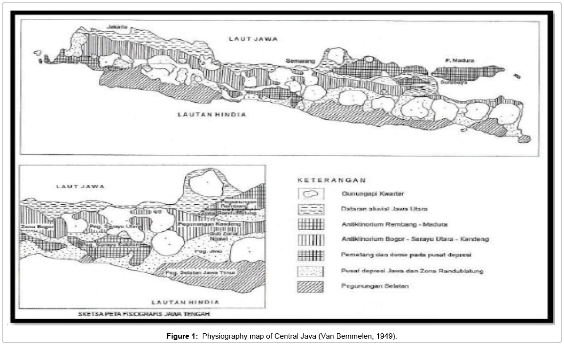
The study area lies on the Bogor Zone which is defined as a 30 km-long anticlinorium stretching in east-west trend [1] (Figure 1). Anticlinorium stretching from West to East. Based on the works from Kastowo and Suwarna [2] (Figure 2), the oldest rock formation that discovered on the western side of North Serayu Range is the Pemali formation. The sedimentary rocks from Rambatan formation, Lawak formation, Halang formation as well as Kumbang formation were deposited above the Pemali formation subsequently. The Halang and Kumbang formations interfinger within the turbidite system on a submarine fan.
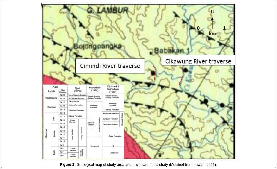
East-west trending folds and thrust faults appear to be the dominant geological structures in the study area as shown in the regional geological map [2]. These are caused by the subduction of the Indian Oceanic Plate under the Micro-Sunda Plate that reached its peak in the Plio-Pleistocene [3].
Research methodology
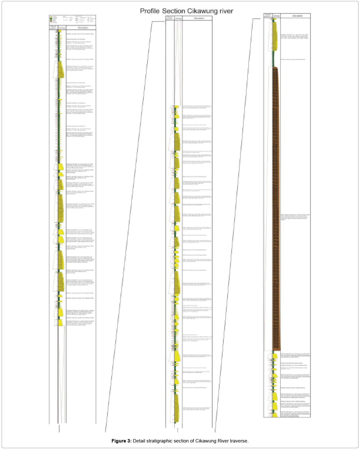
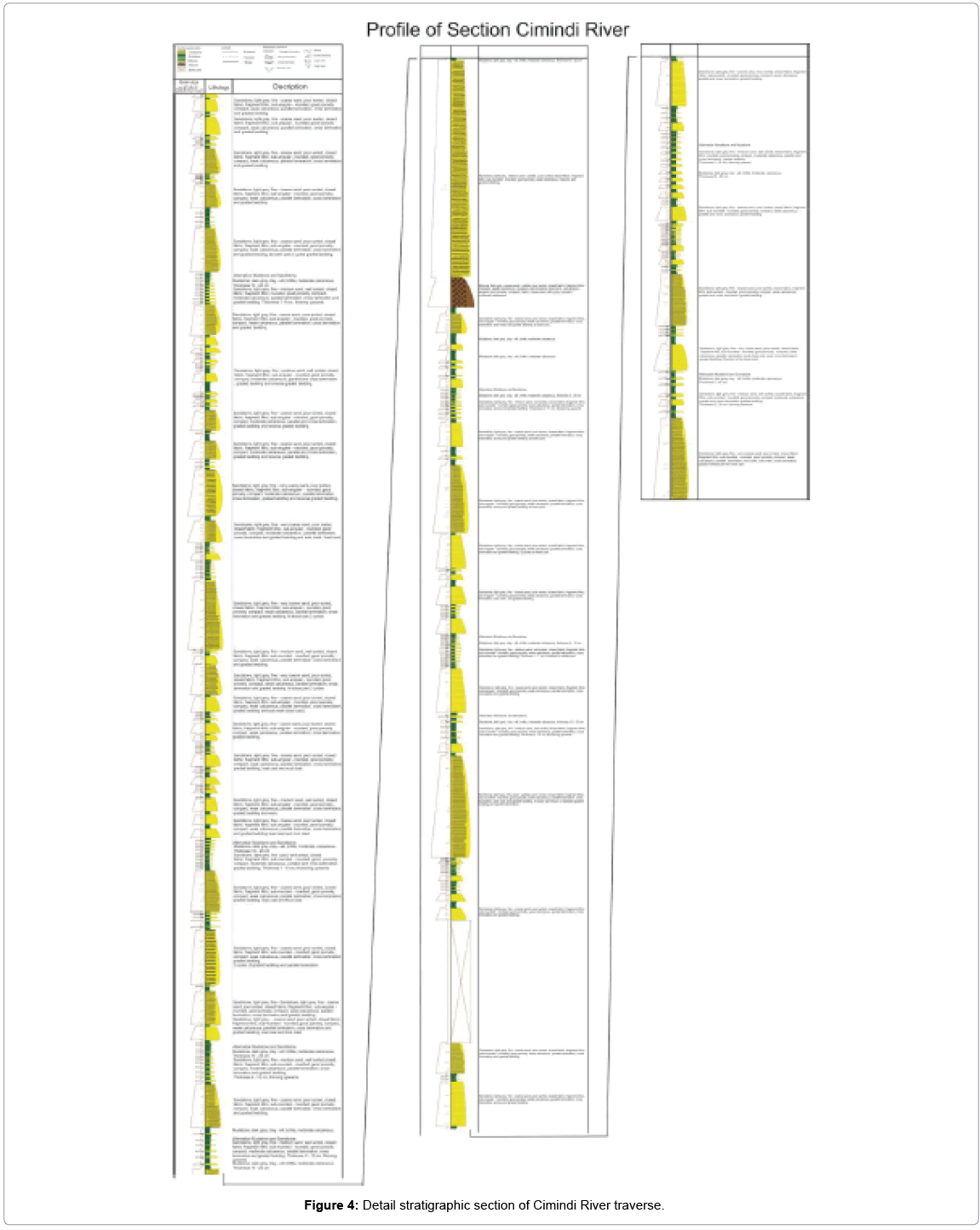
The general framework of this study is based on a detailed stratigraphic section of Halang formation from a field study at Cikawung and Cimindi river (Figures 3 and 4) and a Geological map as well as facies analysis carried out by Irawan [4]. This study uses Stow’s Facies Classificication [5] as a framework method to analyse the vertical succession and sedimentary structures found in the sedimentary unit in order to make a correlation between stratigraphic sections that exposed along the two main rivers in the study area.
Results and Discussion
Detailed observations on the Halang Formation along the Cikawung and Cimindi River were able to define 6 facies classification within the Halang Formation (Table 1).
| Class Facies |
Group Facies |
Description | Interpretation |
|---|---|---|---|
| A | A1 | Breccia, dark grey, very coarse sand boulders, poorly sorted, badlydisaggregated, opened packaging,compact, calcareous, angular – sub-rounded, poor porosity, coarse sand matrix, compact. Fragments consist of igneous rocks (basalt-andesite), sedimentary rocks (sandstone, mudstone) and limestone. | In-channel depositssedimentation systemvia a concentratedflow with debris flowmechanism |
| B | B1 | Sandstone, light grey, fine-very coarse sand, moderately sorted, closed fabrics, compact, alcareous, sub-rounded, rounded grain shape, good porosity, sedimentary structures not found, clasts are mainly lithic fragments. | In-channel depositssedimentation systemvia a concentratedflow through grainflow mechanism |
| B | B2 | Sandstone, light grey, fine-very coarse sand, well sorted, closed fabrics, compact, calcareous, lithic fragments, sub-rounded-rounded grain shape, good porosity, clasts are mainly lithic fragments. Sedimentary structures: solemark, parallel lamination, reversegradded bedding, cross lamination and graded bedding with thickness of 1.6 m. | Non-clasticturbiditesediments; generallyassociated with thechannel and the frontal splay, deposited by the quick-current system,eroding the layerbeneath. |
| C | C2 | Silty Sandstone, very fine – medium,rounded, calcareous cement, closepacked, well sorted, indurated.Structure: Bouma sequence (Ta – Td). Thickness of individual bed rangesfrom 10 – 100 cm, total thicknessreaches 2-4 m. |
Classical turbiditedeposits within thenon-channelizedturbidite or over bankdeposits |
| D | D2 | Sandstone and mudstone intercalation.Sandstone, light grey, very fine – fine,well sorted, close packed, rounded,good porosity, calcareous cement, indurated.Sediment structures: parallellamination, cross lamination.Individual bed thickness ranges from 2-5 cm; total thickness ranges from 50 – 200 cm.Mudstone, dark grey, silt-clay,calcareous, friable. Thickness rangesbetween 10 – 16 cm |
Distal turbidites with arelatively calm current. |
| E | E2 | Silty mudstone, dark grey, calcareous,friable. Thickness ranges between 10 –20 cm. | Hemipelagicsuspension from adistal turbidite. |
| F | F2 | Slump deposits from thinly beddedturbidites that formed chaotic beds. | Slumping fromchannel-over bankdeposits. |
Table 1: Detailed observations along the Cikawung and Cimindi River defining 6 facies classification within the Halang formation.
There are four facies associations of the Halang formation in the study area:
a) Outer fan facies association
This facies association presents on the lower section sequence. It consists of facies group C2, D2 and E2 that shows a sedimentation pattern of thinning and fining upward. The common sedimentary structures of sandstone are parallel and wavy lamination. The sandstone thickness ranges from 1-10 cm and suggests a monotonous succession that reaching total of around 1-3 m.
Interpretation: Based on the lithology association, this facies is interpreted to be deposited in a distal system via suspension and weak traction current system. This is indicated by the existence of a sedimentary structure of Bouma sequence (Tb-Td) and occasional presence of graded bedding on thin layer sandstone, which was produced by episodes of weak traction current. Fining upward succession of the sandstone-mudstone alternations indicates that the sediments were deposited surrounding the mouth of the channel in the outer fan.
b) Middle fan facies association
This facies association comprises of the C2, D2 and E2 facies group with the occasional occurrences of the B2 facies. These associations are similar to the Outer fan facies. However, this association is characterised by the presence of coarsening and thickening upwards sandstone succession. The sandstone may reach 5-30 cm thick and shows monotone successions. The total thickness of this facies association ranges from 2-5 m.
Interpretation: Based on its lithology association, this facies association was deposited far away from its sediment source through an episodic strong to weak current traction mechanism suggested by the presence of the Bouma sequence (Ta-Td). The coarsening and thickening upwards in the sequence indicate that the main channel was overfilled by sediments via a gradual process. This caused the finemedium sediments passed the riverbank toward the levee with a high flow regime. This is supported by the presence of erosional surface and parallel lamination within the sandstone body. Overall, this succession is interpreted as creevase splay deposit in the middle fan area.
c) Inner fan facies association
This facies association comprises of the B2, C2 D2, E1 and E2 facies groups, which are different to the other facies by a presence of fining upwards within the coarse to medium sandstones layers. Erosional surface often found at a contact between sandstones layers. Sole marks are common at the bottom of the succession. Graded bedding, parallel lamination, wavy lamination, cross lamination and local amalgamation structures are common. The total thickness of this facies association varies from 5-10 m.
Interpretation: This sandstone-dominated facies is interpreted to be deposited via a traction carpet, which is a current with high concentration and covered by a turbulent flow above it. Coarser sandstones and the presence of mud clast indicate transportation through strong currents that occur in the channel of inner fan in deep marine fan environment.
d) Slope facies association
There are differences between the two rivers regarding this facies association:
Cikawung River: This facies association comprises of A1 and F2 facies that characterised by an irregular breccia pattern or the absence of sedimentary structure, gravels-boulder sized with polymictic fragments and chaotic mudstone and fine grain sandstone layers (slump). The thickness of this facies association can reach 40 m.
Interpretation: Unstable slope are prominent to experience failure. When the failure occurs, the sediments that were originally-deposited in the slope may slide downwards and redeposited as breccia via debris flow mechanism. This implies a gravity-driven, much like a landslide but more concentrated movement, slow-motioned flow of sediments both coarse- (gravel-boulder) and fine- (sand-mud) grained and water. It followed by another landslide that formed slumps through mass flow mechanism; a mud-dominated flow that move relatively faster down the slope compared to the debris flow. Angular grain shape and the coarse (gravel-boulder) grain size suggest that the unit was deposited not far (proximal) from the source.
Cimindi River: This facies association comprises of A1 and F2 facies that characterised by irregular breccia pattern with the absence of any sedimentation structure, gravels-boulder sized with polymictic fragments and chaotic layer of mudstone and fine grain sandstone as slump deposits. This facies association can reach around approximately 12 m thick.
Interpretation: via mass flow mechanism. The fine-grained slumps suggest that the failure in the slope resulted in mud-dominated mass flow deposits. It followed by the deposition of coarser grained breccia that represent a debris flow deposits. Grain flow deposits subsequently deposited following the debris flow. This is a relatively fast current, negligible use of the moderate water content and sand grains collide on to each other.
Based on their grain shape (sub-angular-sub-rounded), sizes (gravel-boulder), fabric (the fragment floating in matrix) and their polymictic composition, these deposits is interpreted to be deposited away from the source (distal)
Discussion
Vertical succession
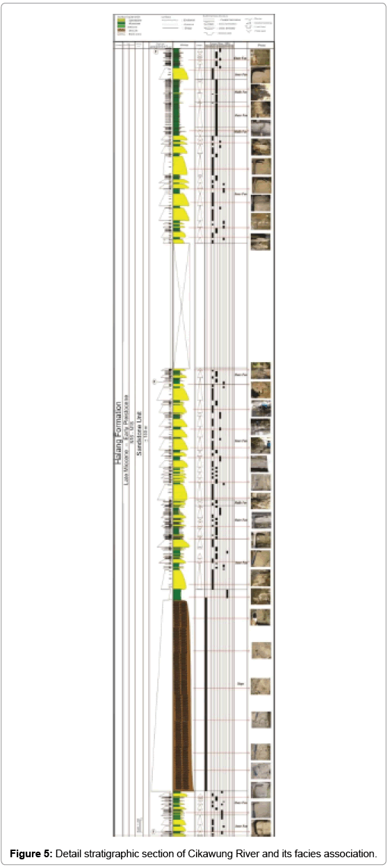
Cikawung River traverse: The vertical successions on Cikawung River indicate a sub-depositional environment from Inner Fan to Outer Fan of deep marine fan. The base of this stratigraphic section is 40 m thick breccia (Facies A1) and mudstones with chaotic stratification (F2 facies) that are interpreted to be a part of the slope deposits. This implies the presence of a downward slope on deep marine fan that is actively experiencing landslide. This lower unit is dominated by a transgressive sequence with a local regressive sequence intercalation. The unit contains significant volcanic materials that suggest prominent volcanic activities during sedimentation. Detail observation on the sequence indicates that the volcanic material content increases in the younger rock unit. Interfingering relationship between the breccia units of Kumbang formation and the upper part of Halang Formation is also interpreted to represent the increasing activity of volcanism that has also change the sub-depositional environment inclining landward. Conclusively, this area is highly affected by the active transgressionregression fluctuations of the sea level.
The lower part of the section also shows changes from inner fan that indicates a transgression to outer fan deposits that suggest a regression sequence. Thick breccia unit at the base suggest a dominant debris flow deposition along the unstable slope. Significant proportion of the coarse, sub-angular-sub-rounded volcanic material (basaltsandesites) included in the breccia suggest that the volcanic activity may play an equally important roles in inducing slope instability that promotes landslide.
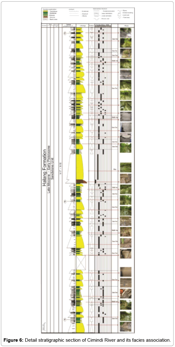
Cimindi River traverse: The Facies Association of Halang formation on this traverse comprises of slope inner fan, middle fan and outer fan. Vertical succession exposed along the Cimindi River shows changes from Inner Fan to Outer Fan depositional environment (Figures 5 and 6).
The middle part of the section consists of breccia (Facies A1), massive sandstones (Facies B1) of approximately 1.5 m and 10 m respectively and mudstone. This association is interpreted as slope deposits.
A relatively thin succession of the slope deposit in the study area is indicating a presence of slope in deep marine fan, which actively experiences landslide. However, the breccia is relatively thin, has finer grain size, subangular-subrounded shape compared to the Cikawung traverse. The sandstones is much thicker, contains gravel-pebble size fragments of sedimentary clasts. These evidences suggest that the unit was deposited quite far from the slope (distal).
Changes from inner to outer fan depositional system suggest changes from transgressive to regressive condition during sedimentation. The middle part of the section shows changes from middle fan to the slope of inner fan system that suggests a transgressive period towards the upper part of the Halang formation.
The presence of the volcanic material signifies volcanic activities as a sediment source for the Halang formation. Increasing volcanic contents in the younger rock unit suggest similar scenario to the upper part of the Halang Formation in Cikawung River.
Deposition Environmental Factors
a. River Cikawung traverse
The analyses of the plantonic Foraminifera fossil, on sample TA10.14A (upper part), TA10.14B (middle part) and TA10.14C (lower part), shows the following assemblages Sphaerodinellasubdehiscens, Orbulinauniversa, Globogerinavenezuelana, Globorotaliapseudopima, Globorotaliatumida, Orbulinabilobata, Globigerina nepenthes, Globorotaliacrossaformis, Globorotaliaacostaensis, Hastigerinaaequilateralis.
The Halangformation was deposited in the Late Miocene – Early Pliocence based on the abundance of Globorotaliaplesiotumidaas an index fossil forages N17-N18 from the middle- and upper part of the section.
The result of benthic Foramminifera analyses on samples from location TA 10.14A (upperpart), TA 10.14B (middle part) and TA 10.14C (lower par) shows the following assemblage: Textulariabareti(Jones & Parker),Dorotiapseudolurris(Cushman), Nodosaria sp. andRectoglandulinatorrida(Chusman)as index fossil for middlebathyal (500 – 1000 m depth).
Following Bandy zonation [6] criteria, the fossil association suggests that the samples were deposited between middle to upper bathyal environment with depth ranges from 200 – 1000 m below normal sea level.
b. River Cimindi traverse
The analyses of the plantonic Foraminifera fossil, on sample TA10.1A (upper part), TA10.1B (middle part) and TA10.1C (lower part), shows the following assemblages: Orbulinauniversa,Globorotaliapseudopima, Globigerinoidesextremus, Sphaeroidinelopsisseminulina, Globorotaliamulticamerata, andGloborotaliahumerosahumerosa [7].
The presence of Globorotaliaplesiotumidaas an Index Fossil forages N17-N18 (late Miocene – Early Pliocene) confirms the same depositional age between the Halang Formation here and the Cikawung Traverse. The result of benthic Foraminifera analysis on samples from location TA 10.1A (upper part), TA 10.1B (middle part) and TA 10.1C (lower part) found the following fossil assemblage:Planulinaariminensis (D'Orbigny), Gyroidinasoldanii (D'Orbigny), Textulariabareti (Jones&Parker),Dorotiapseudolurris (Cushman) andLagenalaevis (Jacson) as indexfossil for upper bathyal (200 - 350 m depth). Based on the fossil association and the abundance benthic fossil assemblage, the samples are interpreted to be deposited in the middle-upper bathyal environment with depth ranges from 200 – 1000 m below normal sea level [6-9].
Lateral distribution
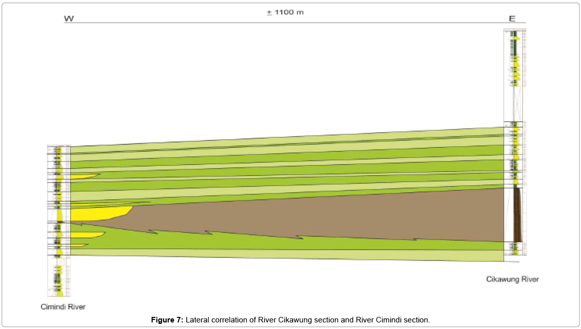
Lateral distribution of the sediment determined by stratigraphy correlation of the both section (Cikawung- and Cimindi section) (Figure 7). The distance of both sections about 1100 m. The result suggests that the Cikawung River is more proximal compared to CimindiRiver. Consequently, the Halangformation is more likely to be sourced from the east.
Conclusion
The following summaries can be made based on this study:
• The Halang formation in the study area is classified into seven facies: A1, B1, B2, C2, D2, E2 and D2.
• Four facies association of the Halang formation are: slope facies association, inner fan facies association, middle-and outer fan facies association.
• Sea level changes that influence the Halang formation influenced by volcanism.
References
- Bemmelen RWV (1949) Thegeology of Indonesia Vol. IA, General geology of Indonesia and adjacent archipelagoes. Government Printing Office: Amsterdam.
- Kastowo, SuwaranaDN (1996)PetaGeologiLembarMajenang,skala 1:100.000.DirektoratGeologi, Bandung.
- Asikin, S (1992) DiktatStrukturKelompokBidangKeahlian (KBK)GeologiDinamis, JurusanTeknikGeologi ITB, Bandung.
- Irawan SA (2015) Geologidanstudifasiesformasihalang di daerahcibaliungdansekitarnya, Kec. Cimanggu, Kab. Cilacap, Jawa Tengah (tidakdipublikasikan).
- Stow DAV, Piper DJW (1985) Fine grained sediments, deep water processes andfacies. Geological Society special publication. Grant Institute of Geology of Edinburg: Scotland.
- Bandy OL(1967) ForaminiferaindicesIn: Paleontology. Esso ProductionResearch Company: Houston.
- Blow WH(1969)Latemiddle eocene to recent palnktonic foraminifera biostratigraphy. EJ Brill, Geneva.
- Mutti E, Ricci Lucchi F (1972) Le torbiditidell'Appenninosettentrionale: Introduzione allanalisi di facies: MemoridellaSocietaGeologica Italiana11: 161- 199
- Shanmugam G (2006) Deepwater processes and facies models:Implications for sandstone petroleum reservoir. Department of Earth and Environmental Sciences. The University of Texas at Arlington: Texas.
Relevant Topics
- Atmosphere
- Atmospheric Chemistry
- Atmospheric inversions
- Biosphere
- Chemical Oceanography
- Climate Modeling
- Crystallography
- Disaster Science
- Earth Science
- Ecology
- Environmental Degradation
- Gemology
- Geochemistry
- Geochronology
- Geomicrobiology
- Geomorphology
- Geosciences
- Geostatistics
- Glaciology
- Microplastic Pollution
- Mineralogy
- Soil Erosion and Land Degradation
Recommended Journals
Article Tools
Article Usage
- Total views: 11510
- [From(publication date):
August-2016 - Aug 30, 2025] - Breakdown by view type
- HTML page views : 10529
- PDF downloads : 981

